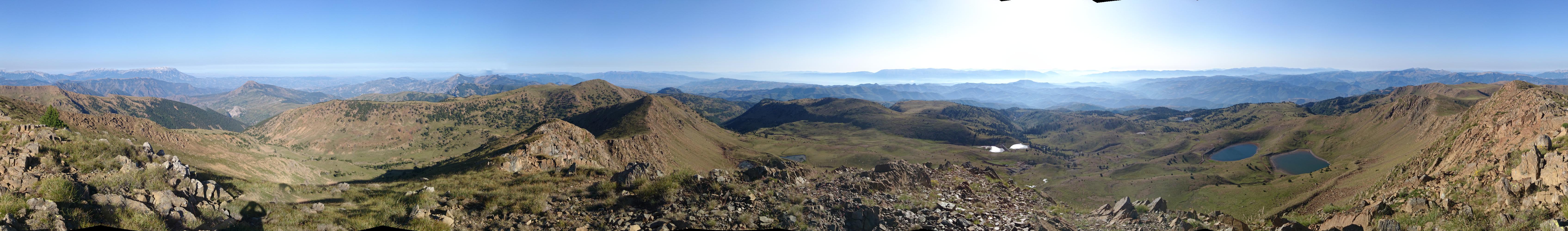
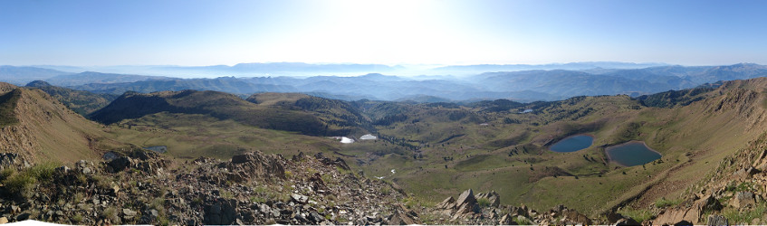
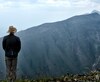
 Part of a 360° panorama from Mt. Valamarës. Click to see all of it in good quality.
During four weeks of which I hiked about three I used mapillary as described in a previous blog post.
The result were 113.384 pictures with 596 GB size (on ext4 – on exfat it was 623 GB).
The maximum of pictures recorded during a day was 9000, the average per day 4500.
After review 101.261 pictures with 561 GB size (ext4) remained.
Hardware used (lent from the Mapillary company):
- 2x 128 GB microSD card
- 2x deltaco Powerbank 10 Ah
- 2x short cables USB-A–µUSB- ~20 cm
- 1x long cable USB-A–µUSB- ~100 cm
- 1x Sony Xperia Z1 Compact (w/o SIM card)
- 1x external 2,5” USB 3.0 drive 2TB
- 1x OTG-Ycable (purchased on my own)
- Anker 40W charging station (Amazon OSM affiliate link) with 5xUSB with 2A output each. My property, can really recommend it.
As of today I finally sent all the stuff back to Mapillary including the images which they will add to the database on-site. I’d need about 90 days to upload them…
A handful of images I uploaded during stays in Hotels. You can find these images here (a village) and here (a minor street in Tirana).
On the way
Usage
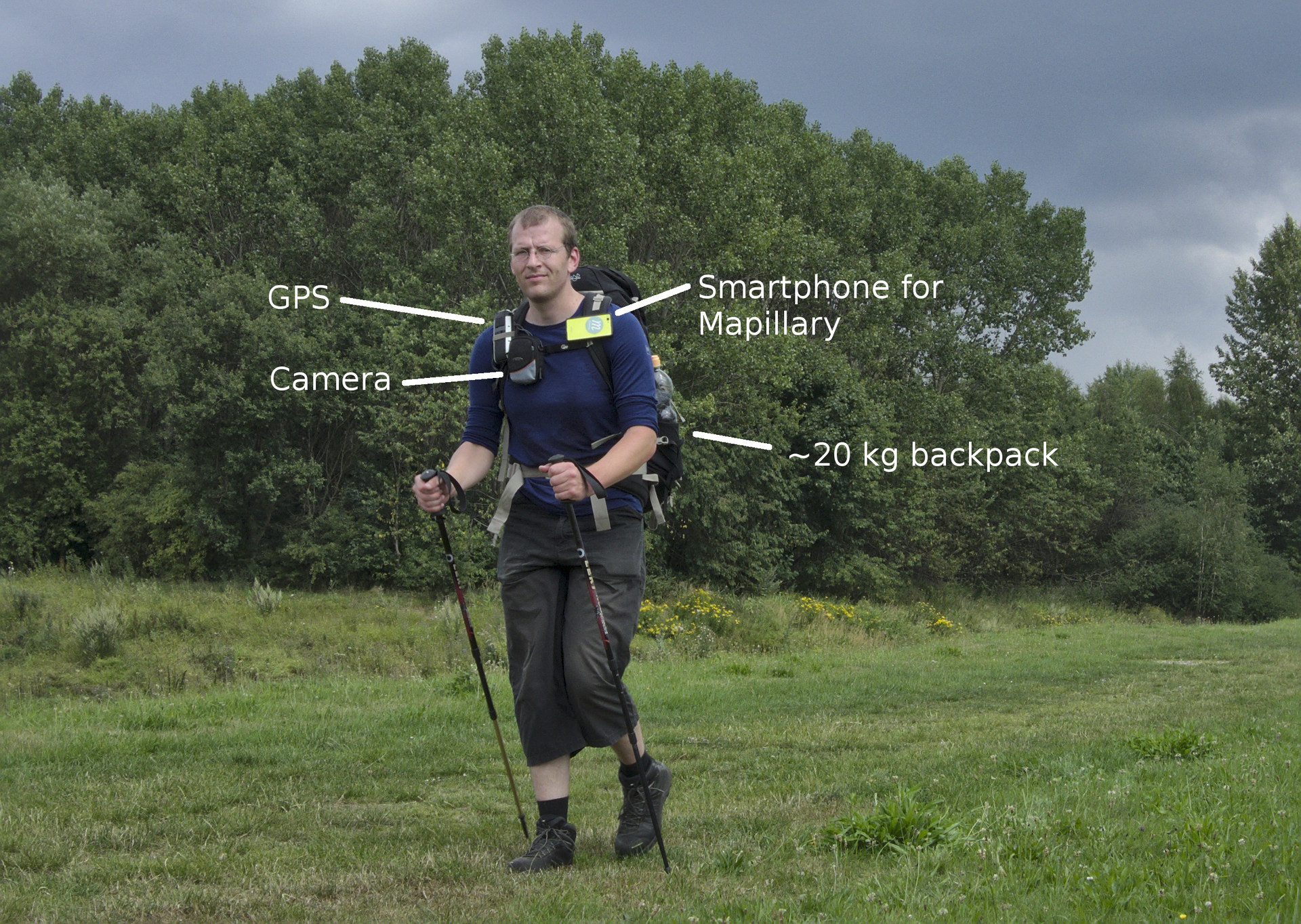
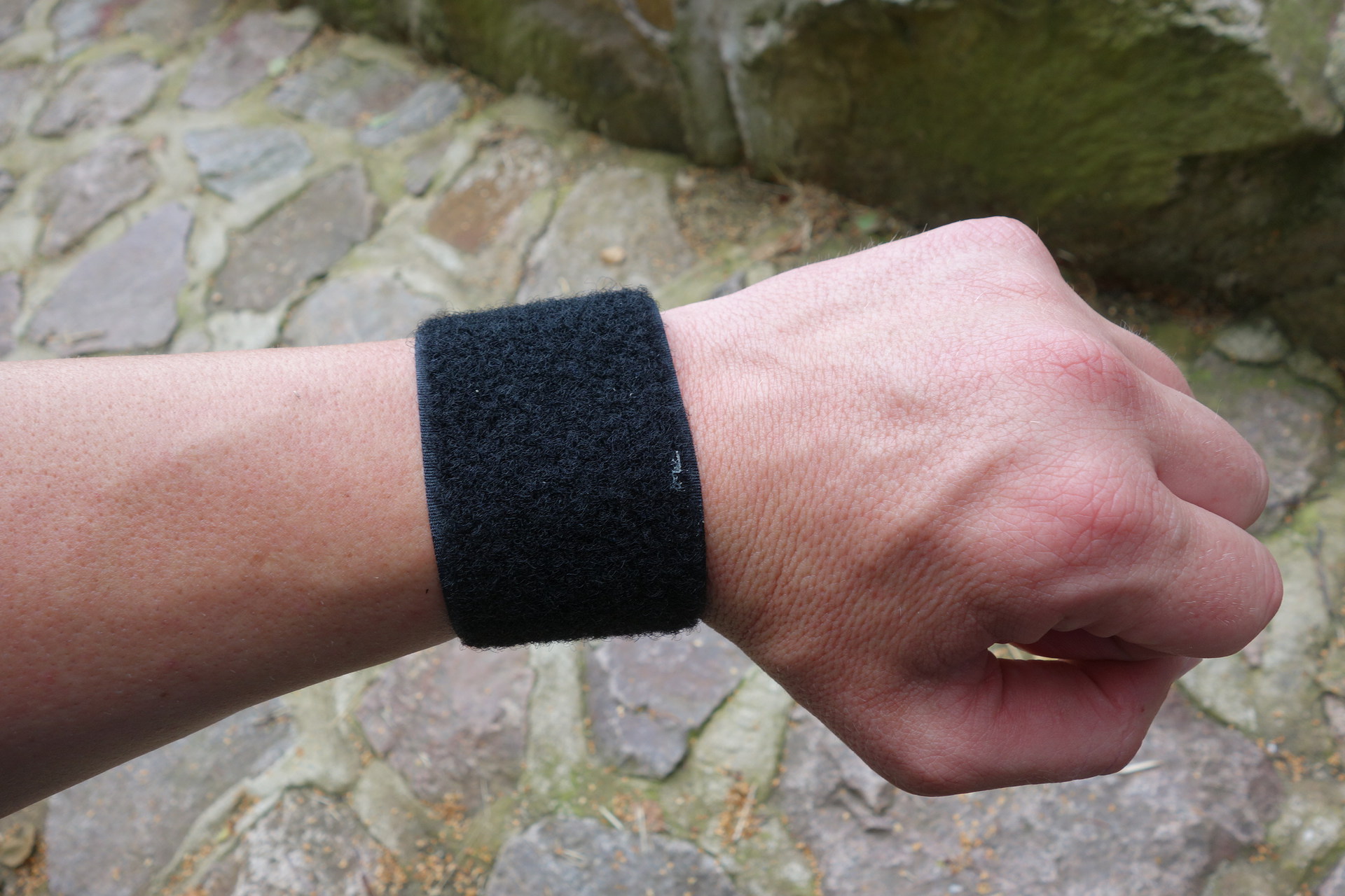
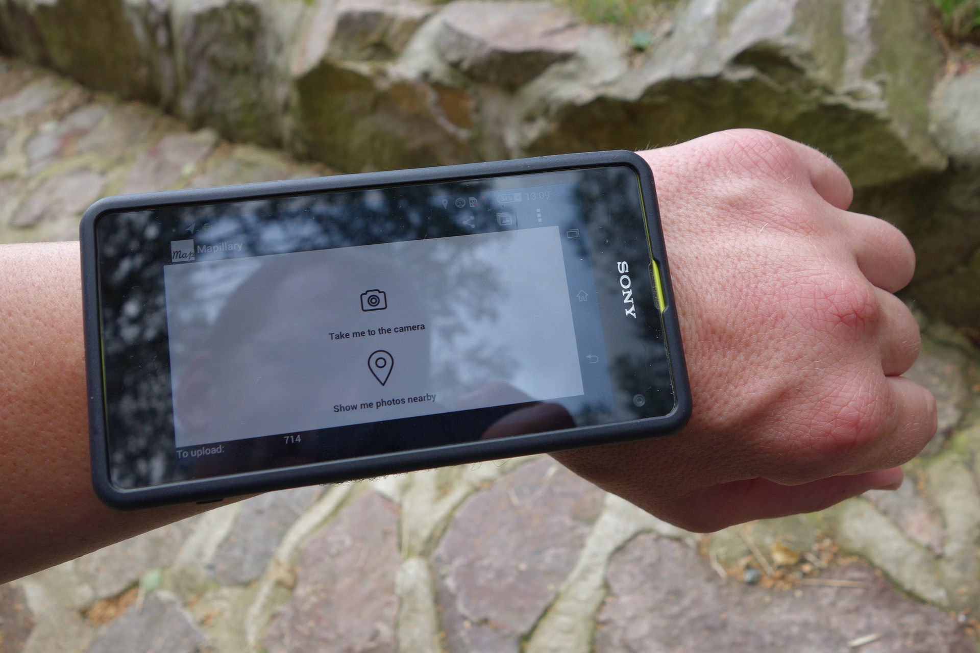
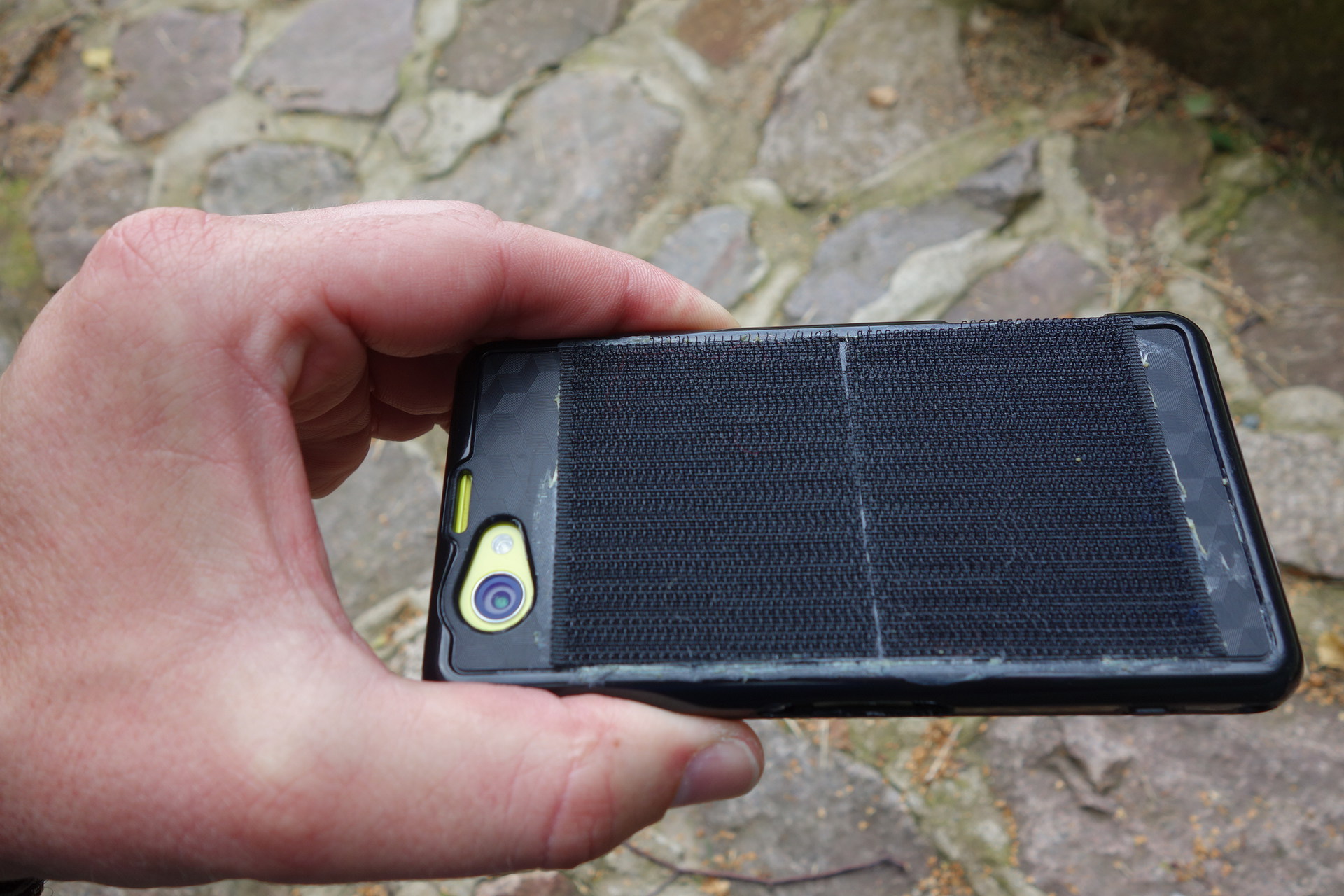
I used the phone with the app blindly: Start the app and start recording, put it front-to-back inside a phone cover which gets attached to the left shoulder strap of the backpack.
One of the Powerbank batteries I put into the lid of the backpack, attached the long USB-A–µUSB to it and fastened it at the left shoulder strap. So the phone could be easily charged while walking. I mounted it upside down to connect it more easily to the cable but that doesn’t matter since the app writes a orientation flag into the photos EXIF data which tells how the picture is to show.
Panoramas
Due to the cumbersomeness of disconnecting, dismounting and peeling the phone out of the cover to switch to panorama mode, take some pictures, switching to walking mode, start recording, putting it in the cover, mounting and connecting it to the charging cable again I mostly did not do so.
At viewpoints or when making short rests I usually just stood there, had a look at the landscape and turned myself slowly around my own axis to let the app make images of the panorama.
Only rarely (at big rests on mountain peaks or when walking a city on mapping purposes with the phone in the hand) I bothered to take pictures in panorama mode.
I just hope that there will be software intelligent enough which can detect little to no movement (based on GPS data) and overlapping image contents to stitch panoramas automagically.
At the hotel
After four days both powerbanks and the phone would be discharged so I had to spend a night at a place with electric power supply. Once I was five days “in the wild” so the last day went without Mapillary pictures.
Since I left the magnet charging cable at home due to bad charging performance and for reducing weight I had to calculate when to charge the phone and when to copy data since both at the same time doesn’t work when using an OTG cable. When I intended to leave the hotel after one night it was a good idea to have the phone’s battery charged in the morning so I tried to reach the hotel with a still quite charged phone, start copying as soon as I was in my room and before going to bed started charging the phone. Since I had two 128GB µSD cards with me capacity was the smaller problem. It really would have been easier if I had taken the magnet charging cable with me.
Nice side effect: I was also able to copy photos from my camera to the hard disk.
Observations
What I experienced so far on
Hardware
Battery life
I was lent the phone with two 10Ah batteries. With them it was possible to cover four days of hiking. But all the time the phone’s statistics say 24% of the energy are consumed by the display. In my case without any use because the phone is mostly operated blindly – I could have done without display.
I installed the app BlackouT which dims the display but does not reduce the energy it needs. The app “screen standby” I found too, but to get it working one has to have the phone rooted and Busybox installed. Though the latter I managed I wasn’t able to get root and the app working (during the trip in a hotel room).
Camera
Several times I had to reboot the phone since the app told me it could not access the camera. Not so often I had to reboot it due to the lack of recognized GPS satellites. Switching off the phone during the night reduces occasional reboots during the day, but does not eliminate them.
Although the camera is said to be a good one, it may only be a good one for smartphones. If you don’t walk in the bright blazing direct sun there is a good chance the image is blurred due to slow shutter while moving.
Heat
Sometimes the phone got so hot it showed irreproducible behaviour. The only possibility was to reboot it.
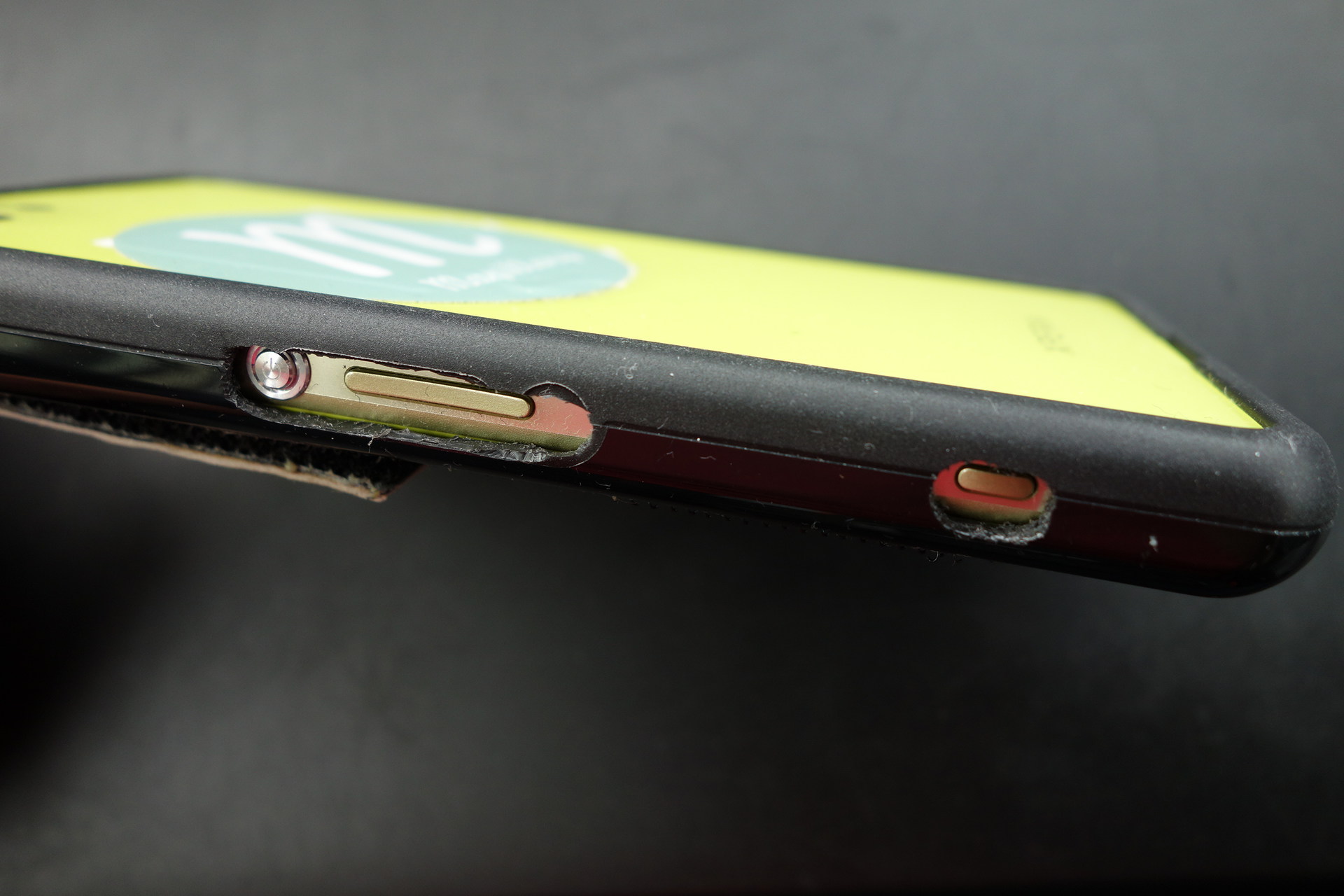
Waterproof
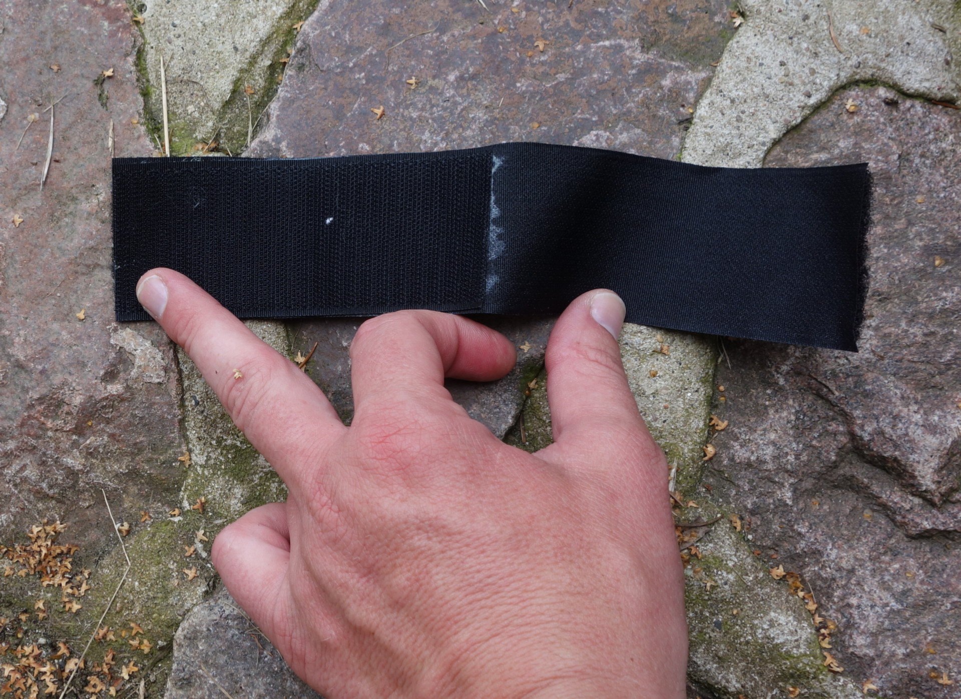
The cover of the micro USB connector I attached and removed quite often. Soon the fitting didn’t fit anymore and a little later went to pieces. Anyway I didn’t dare to check if the phone is really waterproof. I preferred to have pictures during all the holiday to a drowned phone. The “worst” weather I used it was very light rain where I attached it to my rain coat in which I had glued a strip of loop fastener, too.
Software (Mapillary app)
Displaying pictures
Since I am no smartphone user at all I am not sure if this issue depends on Mapillary or a dedicated photo viewing app. Displaying the pictures taken is fine as long as there aren’t too much of them and you want to see the most recent taken pictures (remember I took per average 4,5k pictures a day). You have to scroll down all the way by hand, you cannot grab the scroll bar and pull it down. And after you had a view at an image and went back to the list you are at its very top again. Even switching from displaying horizontal to vertical lets the list go back to the first image.
Error handling
As mentioned above, sometimes the app could not access the camera and crashed.
When I experienced this live it was not too bad, but when it happens during recording I didn’tt realize this and walked on taking no more pictures. Even when I set the app to “make shutter noise when taking picture” it didn’t not help much because after a while one becomes accustomed to the sound. Usually it took me a while to realize that the sound (and the recording) had stopped - especially in cases were the app takes pictures only now and then.
The same goes for “warn at $(certain_amount_of_memory_left)%”. I am not sure if the phone did warn before, but once I discovered it showed up a message “picture could not be saved” after each picture taken. The SD card was full… Give the app a warning sound!
Suggestions
## Invincible mode:
Due to the way I used the phone (described above) it was not easy to know the state it and the app were in. Often it happened that I set the app to recording, put it inside the cover and attached it to the shoulder strap – and there was no shutter sound. So to have a look what the issue is one needs to take the cover off again and peel the phone out. By the way most of the time the phone was connected to a spare battery to charge while walking which made “have a look at the display” still more complicated.
It also happened that by pushing the plastic cover the touchscreen received input - and when this happened at the wrong place recording could stop.
As “invincible mode” I suggest a kind of lock mode in which one has to enter a kind of unlock “code” – touching the buttons in a certain order – to be able to access the app.
Speech commands
Some speech commands to start/stop recording and switch the modes (walking/panorama) would be helpful.
Multi level panorama
Being on a mountain top one has a great view. So great even that making a panorama with only one row of images is not sufficient. With my “good” camera I usually take three rows for a big panorama:
- Sky with a little horizon
- Sky and horizon in equal parts
- Horizon and below
Write level to Exif
Since it is very likely the phone is out of level while walking it could be useful to store the degree the camera is out of level to be able to correct the image easily.
Time lapse
Good sequences (not shaky, not blurred and well matching images) Mapillary could present as time lapse movies.
Post holiday
## review
To review this amount of pictures I struggled a little to find the best way.
Just putting all the images in one folder and looking at them one by one is a slow method to sort them out. A lot of picture viewers are really slow on such a task, especially if they create a file list. The viewer ‘‘feh’’ is fast at displaying images from a folder containing zillions of them. But it still would take a lot of time to watch picture by picture.
I finally chose to create a folders per each day and hour which is easy because of the naming of the images: 2014_08_14_18_25_30_374.jpg (year, month, day of month, hour, minute, second, splitsecond)
Inside a folder containing images this line creates folders for each day and hour and moves the regarding images there:
for i in $(ls -1 | cut -d “_” -f 1-4| uniq); do mkdir “$i”; mv “$i”g “$i”; done*
With the picture viewer geeqie and fast preview settings it doesn’t take too long to sort the bad images out. I mostly scrolled fast the preview thumbnails to find them. For me “bad images” are unintended selfies, shaky, over- and underexposed ones or where the biggest part of the images is obscured by stuff in front of the lens (trekking poles, arm, hand etc.).
Duplicates, triplets and so on I mostly didn’t remove since some intelligent automagism could create a panorama from several files. After reviewing some thousand images I started to name these and “real “ panorama pictures by adding “pano” to their name. For the little parts of the journey I used transportation I also named the images accordingly.
Image content
When the way goes steep uphill the pictures show a close up of the path without much landscape, often with the trekking poles. When descending the opposite happens: A lot of images seem to show the same piece of the landscape but not the path on which one walks downhill slowly.
Due to the walking movements it happens a lot that the phone goes alternating out of level to the right and to the left or shows alternating more of the left side of the path and then more of the right.
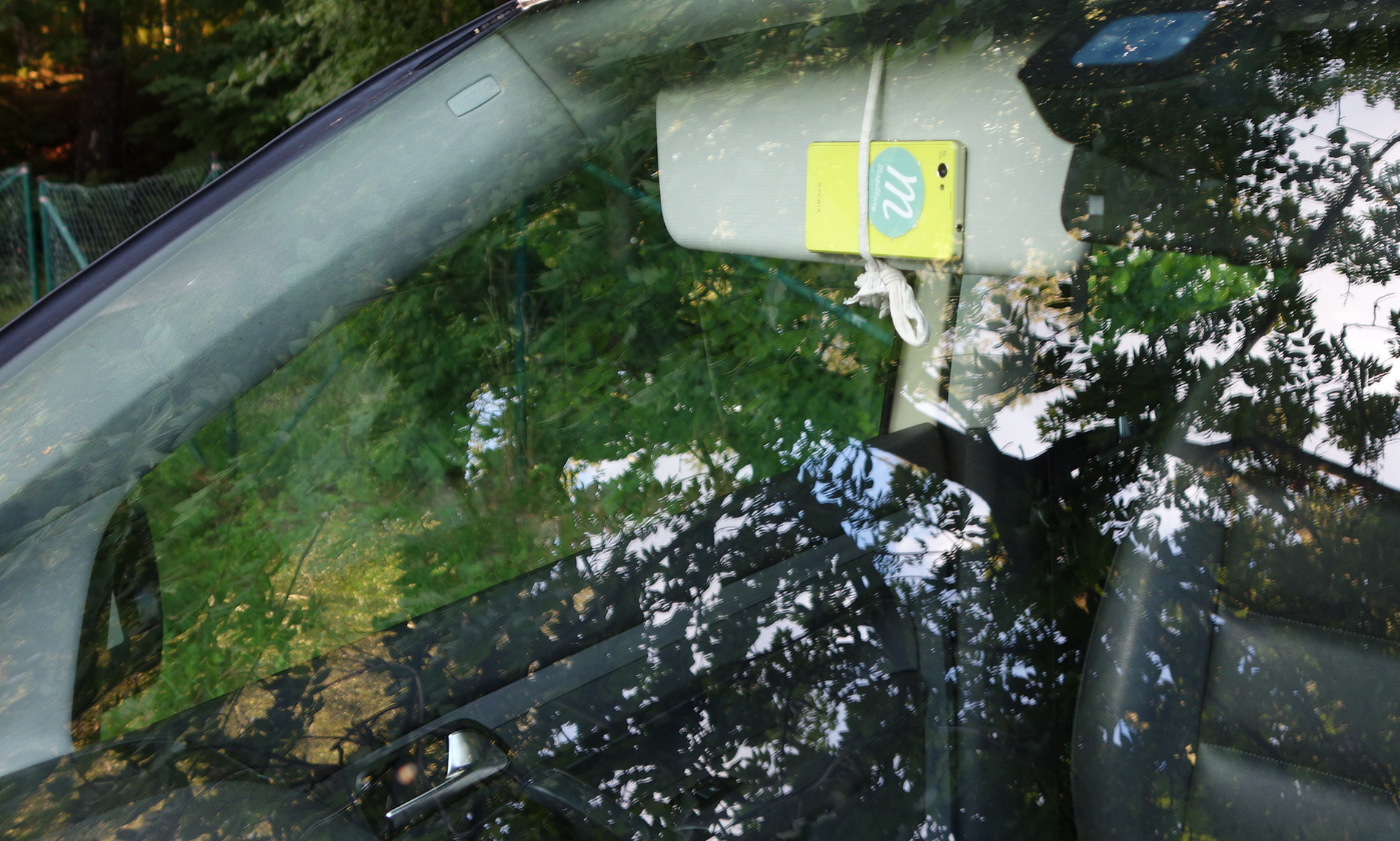
Really bad roads Mapillary cannot depict when the phone is mounted to a cars front screen. Either the car is too slow or it shakes too much. And when you hold the phone with your hands you sway it around a lot… In some days you can see how this looks on Mapillary – with the sequence from Kroi Bardhë to Kumbull.
As I wrote at the hardware section already: It is very hard to get unshaky pictures when walking around without bright sunlight. Using Mapillary in the early morning or late in the evening? No way you get good pictures with your smartphone.
Mapping
When it comes to mapping it is of course not bad to have as much data available as possible. But loading all the images of just one day with JOSM requires a potent computer – and looking at each image for mapping gets soon tiring. You should still collect POI with your GPS/a matching app or make photographs of interesting POI with another camera to know, where the interesting parts to map are.
When you have uploaded all the images to Mapillary without local backup and want to map using them it gets difficult. You have the choice of either look at the images on the Mapillary site, draw your conclusions and use the editor of your choice. But for me being dedicated to JOSM this is an awful way to map with photos. Also the script ubahnverleih wrote to download images from Mapillary and get them into JOSM gives results which don’t satisfy me. It creates a gpx file with the images embedded. Contrary to loading images directly into JOSM where you are able to scroll back and forward through them you have to click on each single icon to see the image thumbnail - and click once more to see it in high resolution. Afterwards you have to close two windows, too.
My recommendation: keep a local backup of the images until you are done with mapping.
Conclusions
- Mapillary is a nice way to collect images during (holiday) activities without bothering too much about technology.
- Due to hardware limitations of smartphones you need a lot of light to get good images.
- While walking it is not easy to make good, leveled and not blurred images.
- For mapping purposes (with JOSM): keep a local backup and still collect POI with another app/device to easily find the highlights of the journey.
Despite all worries, the 1kg extra load and some occasions I really cursed the stupid hardware¹ I want to thank the company Mapillary to enable me to collect that amount of data in remote regions of Albania. In some way every photo is historic but I think since Albania is a fast changing country and little known to most Europeans these images may get some attention.
¹ “Great! I walked that breakneck path, didn’t fall down – and the camera didn’t work and I have to spend some minutes for rebooting the phone and restarting the app!!1 %$§£Ω¤”
Since publishing this post I added some paragraphs, the image and fixed some minor errors
Location:
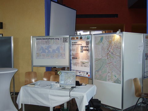
 OSM booth
.jpg) Heinz Stücke
Heinz Stücke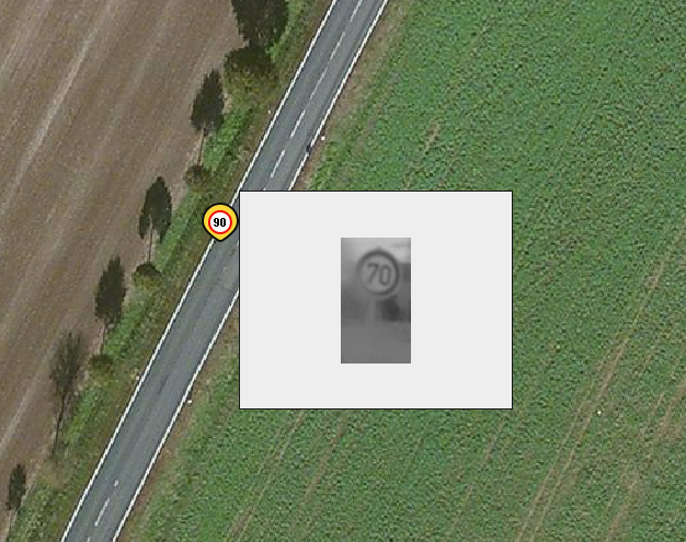 (Sign ID 25587,

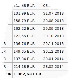
 revenue with month of generation (pay-out two months later)