
Sharing from my post on https://blog.georeactor.com
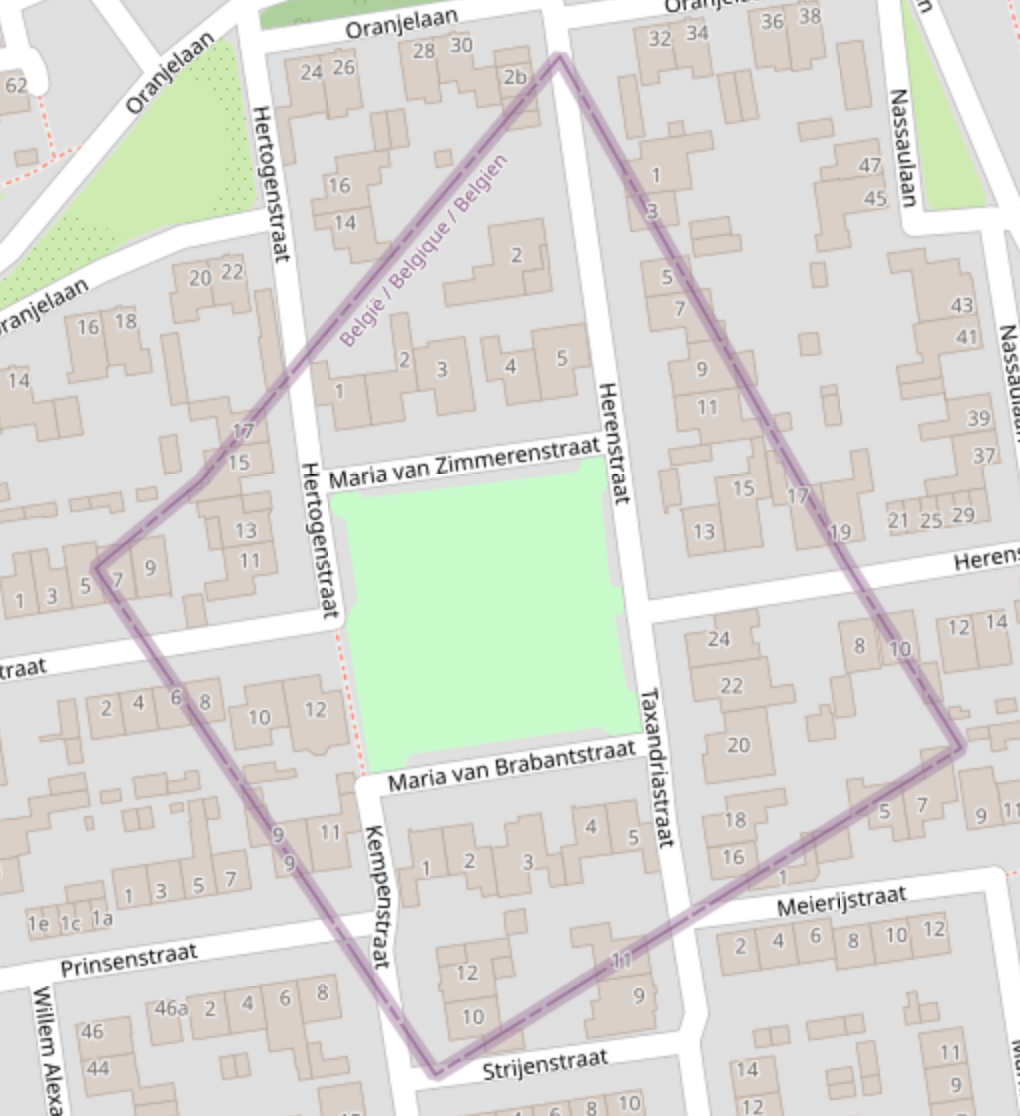
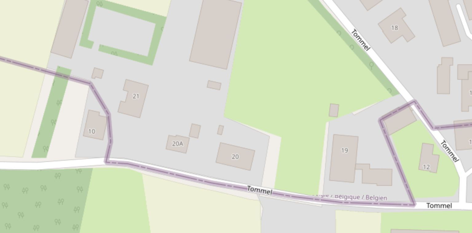
Belgium’s Baarle-Hertog and the Dutch Baarle-Nassau overlap in one town riddled with border crossings and enclaves. Let’s take a look at OpenStreetMap:
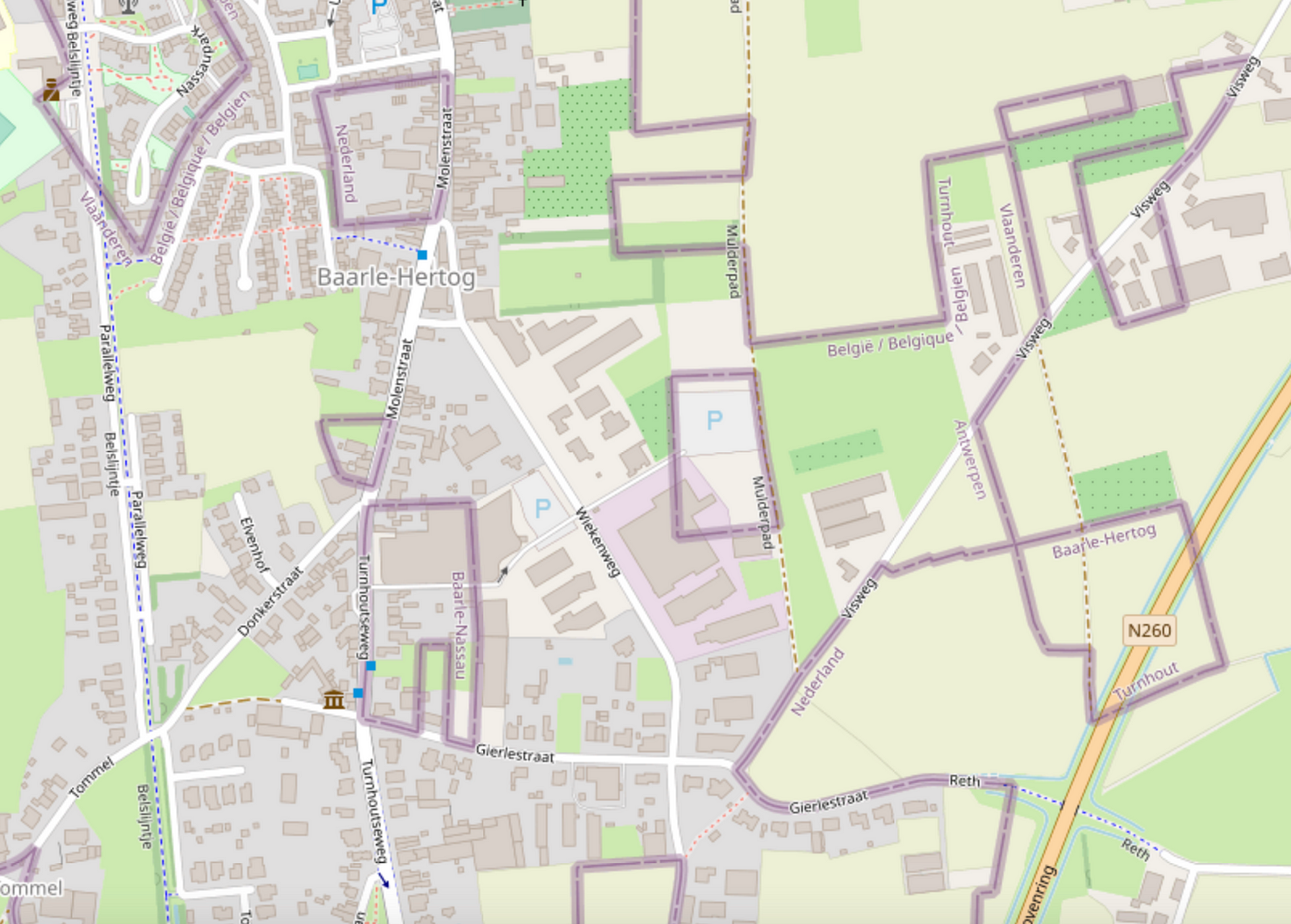
Wow, it looks complicated!
Legend depicts Baarle as a Kafkaesque theme park where buildings swap countries and laws are fluid. Sample anecdote:
There was a time when according to Dutch laws restaurants had to close earlier. For some restaurants on the border it meant that the clients simply had to change their tables to the Belgian side.
I likely learned about this town from the Google Sightseeing Blog a long time ago. As a maps nerd, I knew that I had to see it for myself one day.
Getting there
In April 2023, I took a train from Brussels to Antwerp, checked out the award-winning Port Authority Building, then another train onward to Turnhout, then a bus to Baarle-Hertog.
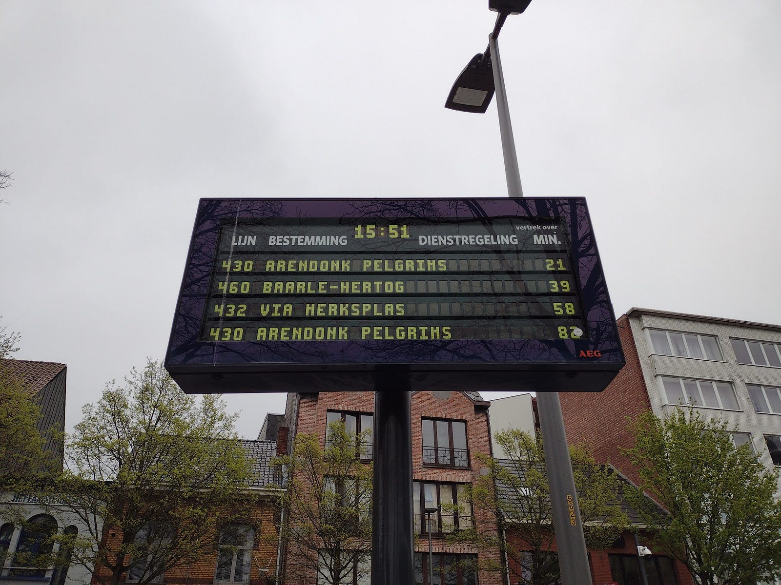
If you’re coming from the Dutch side, there’s a bus from the Breda train station (these bus systems have stops a few meters apart at a commuter parking lot on Sint-Janstraat).
History
When I read books about enclaves last summer, the authors explained that this situation was once not so unique. As fiefdoms and city-states got aggregated into kingdoms and counties and nations, irregular borders would go away or get simplified by the higher-level government. In the 1840s, the UK eliminated most of its chaotic county enclaves, though some remained into the 1970s. Traditional boundaries surfaced at odd times in the 20th century, such as areas of West Berlin inside of East Berlin.
After India and Bangladesh swapped territory in 2015, the only remaining ‘double enclaves’ are here and between UAE/Oman [I was thinking about Cypriot villages within Dhekelia (UK) on the island of Cyprus, but Dhekelia has access to the sea and that gets into enclave/exclave terminology].
The borders of Baarle have been set since 1995. They had previously been somewhat defined in 1974, with descriptive borders such as [translated]
[the border] is formed by the middle of a ditch in an approximately northwesterly direction up to a stone crossing the old road from Baarle-Nassau to Hoogstraten. Thereafter the boundary runs in an approximately westerly direction, approximately parallel to said track, and is formed by an approximately straight line through the center of several ditches and ditches over a post called “afgevild paard” [skinned horse] to a point 1.8m south of a stone. The border then follows a line marked by pickets in an approximately westerly direction to the northeast side of a ditch, crossing the Hoogstraten…
Speculation
Some uninformed theories for the longevity of Baarle: - A sign hinted that swaps happened when buying, selling, and inherited land. This could help explain odd blocks of borders in fields. - The road connecting Baarle-Hertog to the rest of Belgium passes through possibly valuable territory that the Dutch would not give to Belgium. - Conceding Baarle-Hertog to the Dutch could trigger Flemish areas to leave Belgium - By the time of the 20th-century definition of the border the tourism, Schengen, and EU rules made it less urgent.
How wild is the border in 2023?
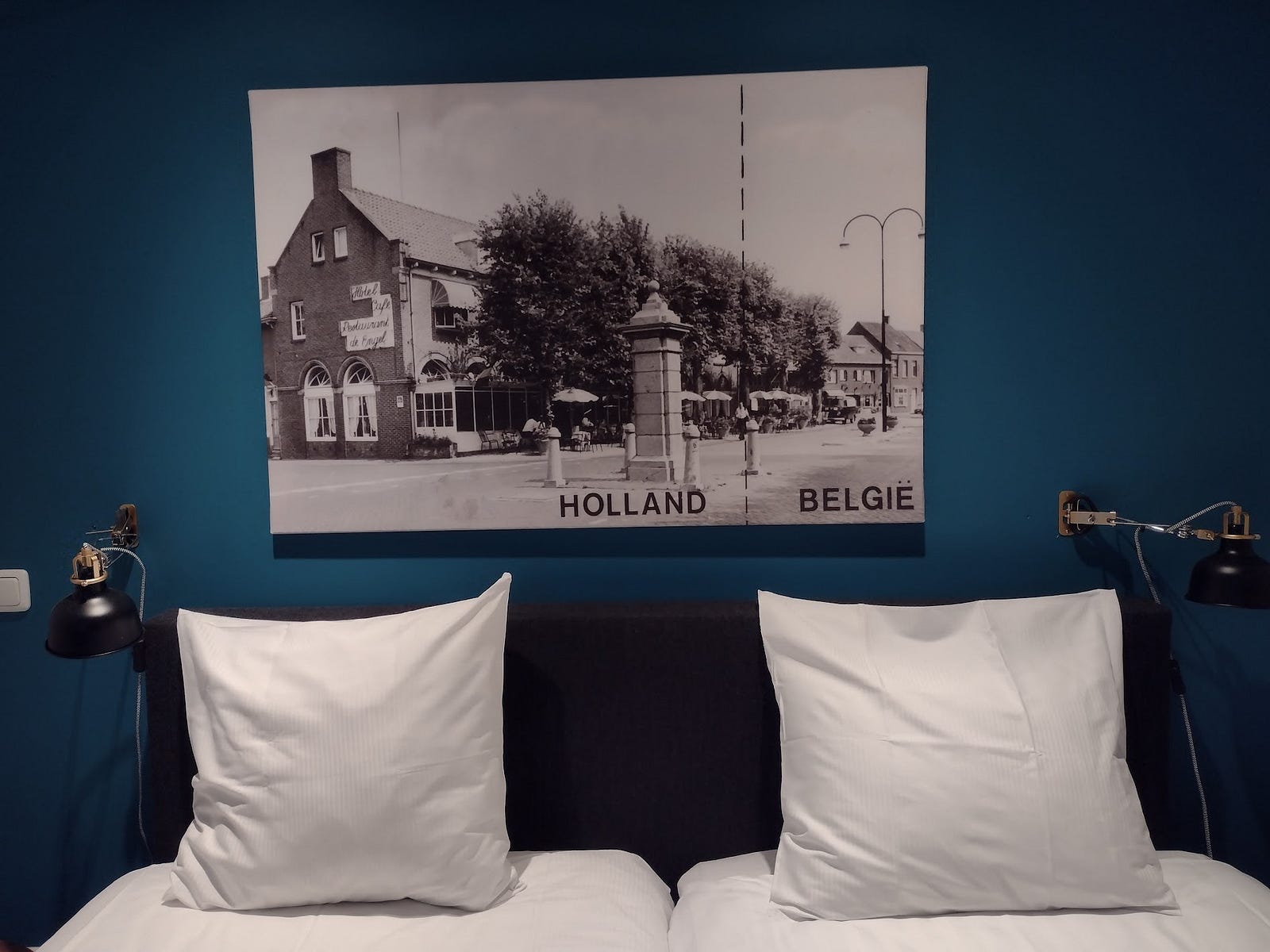
I stayed at Den Engel, which has a nice restaurant and fry counter, with ~10 rooms above. Their outdoor seating comes up to the border, but clearly stays within the Netherlands:
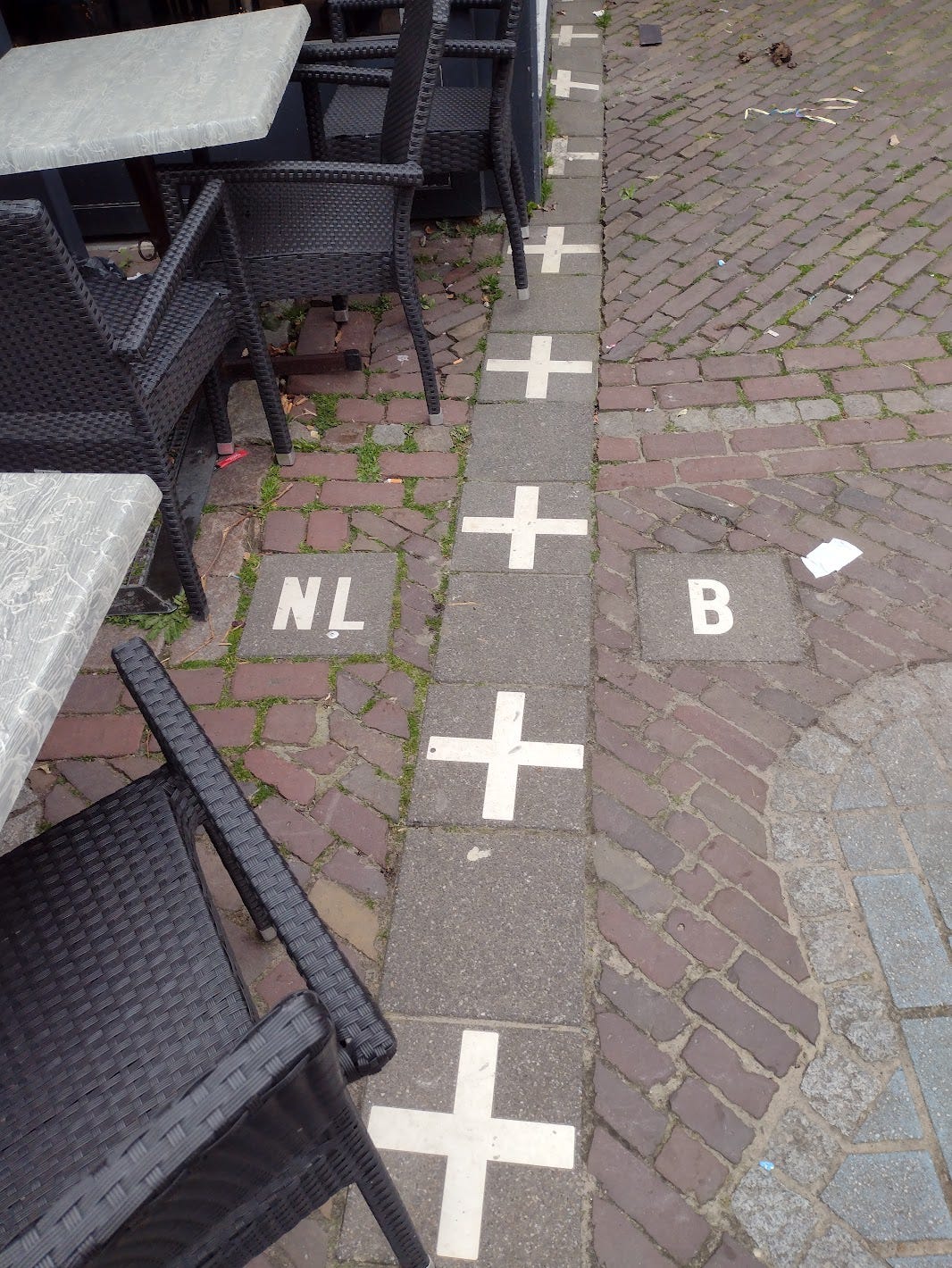
There was some care taken either when building or when drawing borders. Despite a twisty border at this corner, buildings tend to fall into one country or the other:
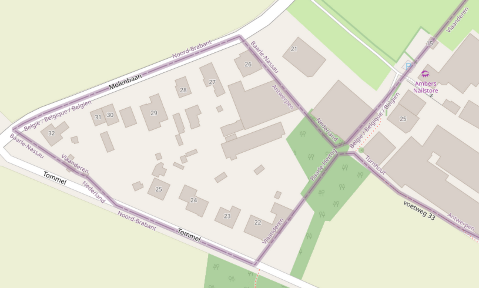
Though the historical Baarle could have been more criss-crossed by borders, it seemed to have been simplified. I decided to search the map to find which buildings currently sit in both countries. Only a few are open to the public:
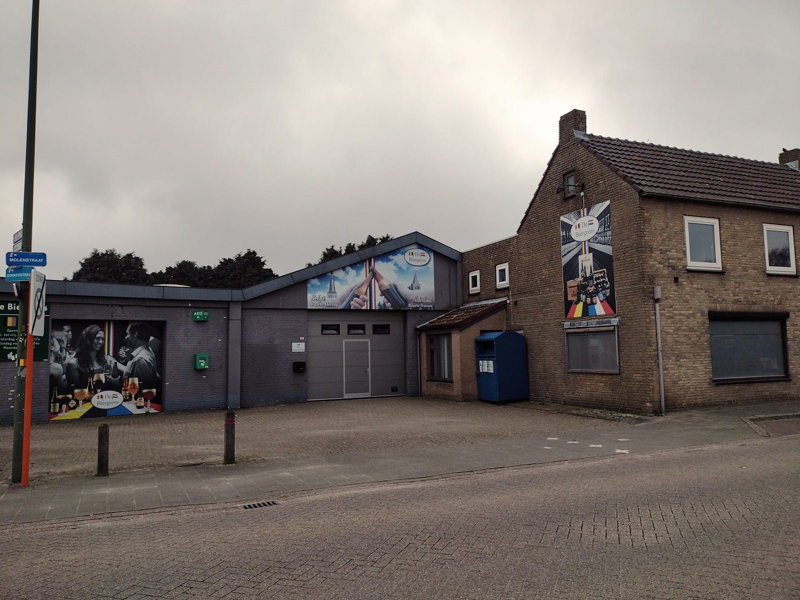
- Drankenhandel Hoefnagels - a beer store embracing its border status. This is part of the world’s smallest counter-enclave. Before both countries adopted the Euro, they had two prices and two cash registers. The border goes right through where the beer bottles meet above the door. It’s closed on Mondays.
- Goossens wonen en slapen - this is an ordinary furniture store. Google gives its address as a service entrance in the Netherlands, but the parking and customer entrance are totally in Belgium. The Dutch side had this odd siding which looks like filled (or slideable?) doorways.
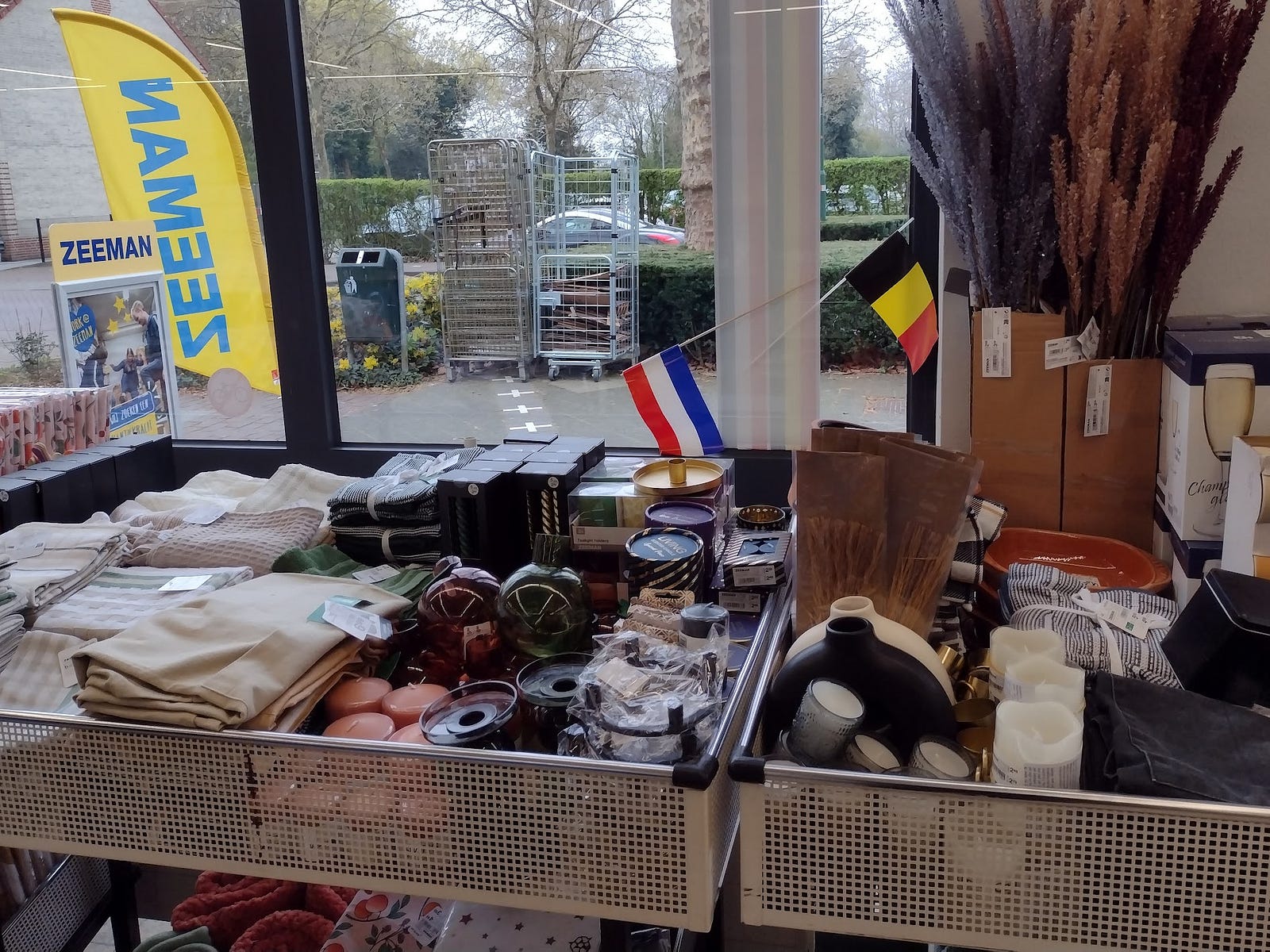
- Zeeman (clothing store with cleaning and kitchen sections; think TJ Maxx). On Sunday night there were kids doing bicycle tricks over the border on the sidewalk. Inside there was a cute yet understated border marker. I bought slippers and Q-tips.
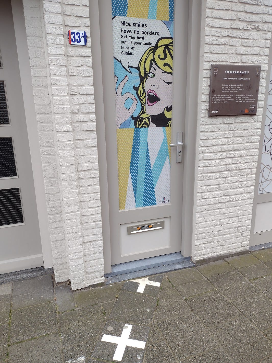
- The space around the corner from Zeeman was recently an art gallery. During 2020 the owner was interviewed about differing mask restrictions. That gallery has relocated to a Belgian storefront. The new tenant is Clinias, a pleasantly self-aware dentist’s office.
- a shared library / community center (I walked through the first hallway, didn’t see anything out of the ordinary or overtly divided)
- shared town hall (a sign outside explains that the Council room on the upper floor is split, and Belgian weddings must be performed entirely on the Belgian side)
I’m not going to walk into a warehouse or an apartment to bother people about the border, so… that’s all that I have!
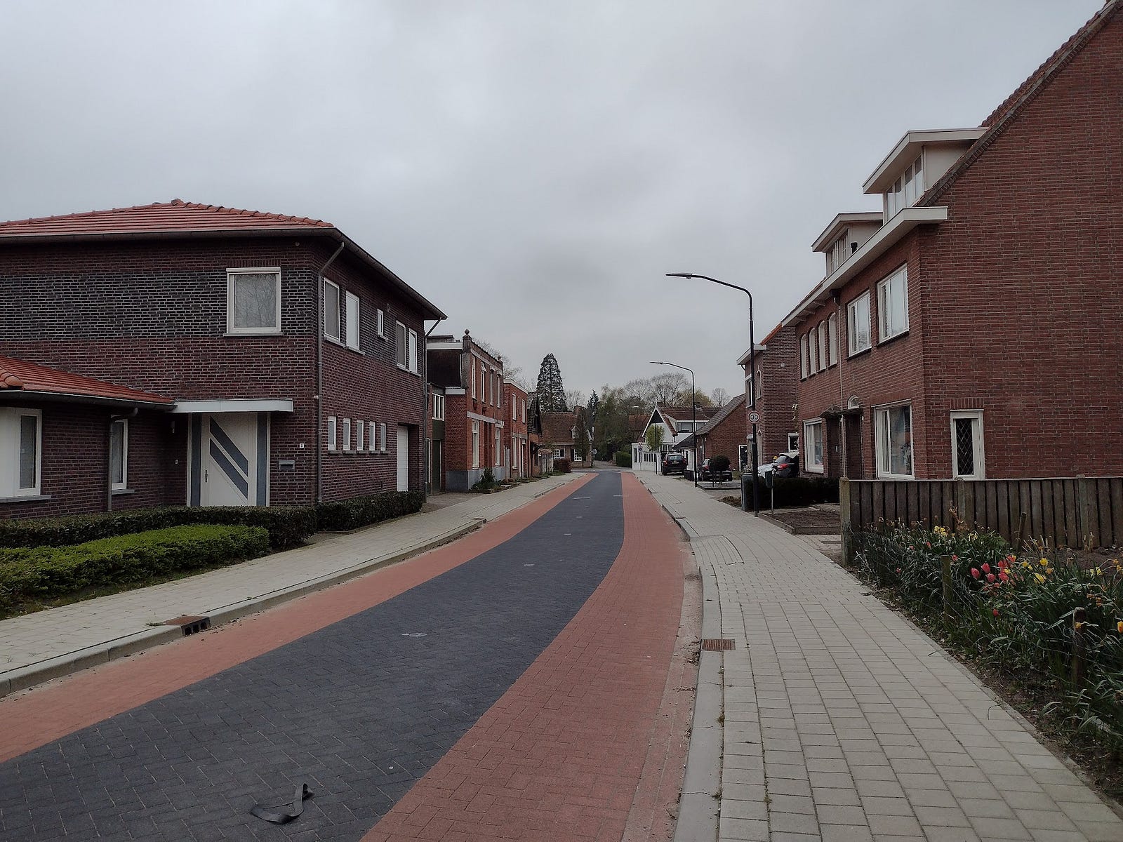
These residential neighborhoods were built with seemingly little concern for the border. No cross-border Airbnbs are available =(
There are multiple streets where a border goes down the middle. I wondered if that was the meaning of the brick in this neighborhood, but it could easily be European traffic calming and parking:
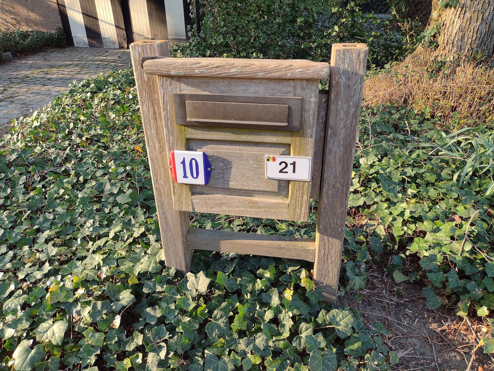
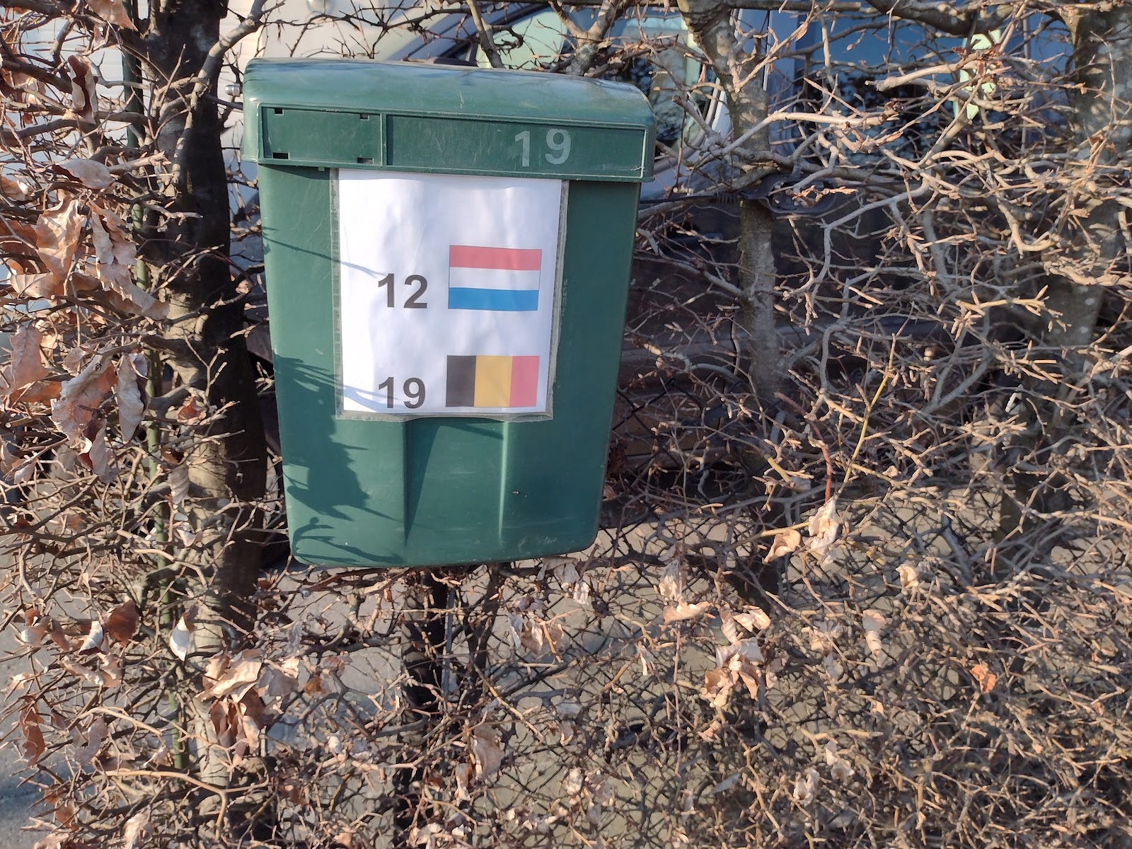
In the southwest, outside of town, there are farms with buildings in both countries. I found two mailboxes with dueling house numbers.
Here’s a look at OpenStreetMap to explain the situation:
Some Tourism Notes
Rooms at Den Engel were cozy. I should note though that they are not accessible for elderly or disabled.
Residents have a monument for smugglers (particularly around butter I think?) and today there is a cluster of firework stores in Belgian territory. There was a small reconstruction of a radio tower set up by the Belgian resistance inside an enclave during WW1.
Bakkerij Adams was not on the border, but it was tasty. There’s a window into the kitchen. The cashier (and an elderly customer) answered my questions about their pastry.
Several bike paths pass through Baarle and connect to nearby towns in both countries. A sign recommended an Enclaveroute.
Final thoughts
Just as the Euro and Schengen can (in their better moments) give a feeling that we live in a special peaceful era, walking to the bakery and discovering you’ve crossed the border 3 or 4 times, including by crossing the street, gives a warm fuzzy feeling. Is being Dutch about flying the flag and eating pancakes and Tony’s chocolate in the supermarket? Is it about who sends you a tax bill?
By the Clinias dentist office, a sign reads [abridged / translated]:
the lion of the Netherlands on the pole, with crown and sword…
On the other side the Belgian Lion. no crown can oppress him
This couple doesn’t fight each other in Hertog en Nassauwe:
but whoever besieges their Twin Village.
two pairs of claws strike him
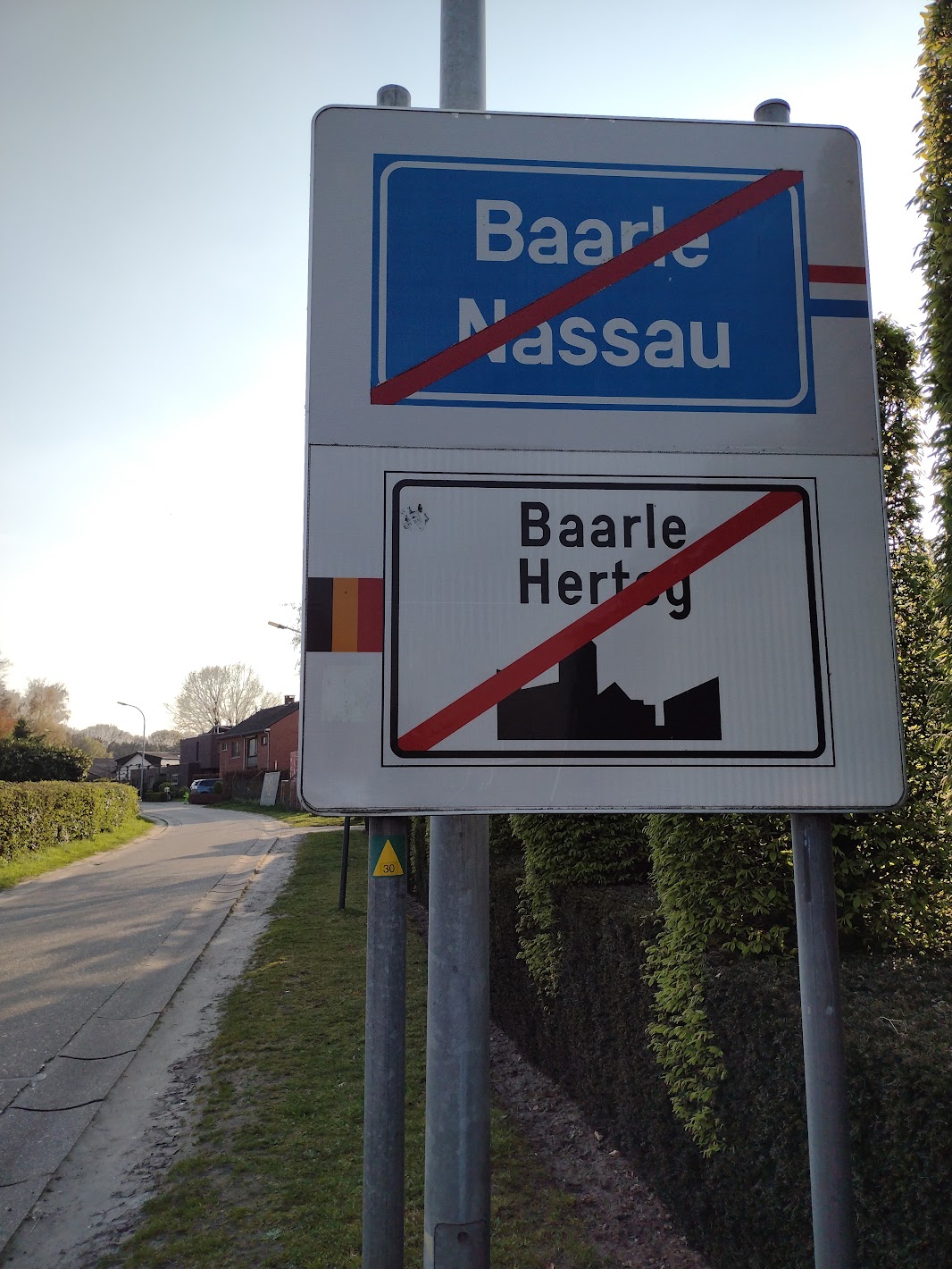
I’ll leave you with this road sign showing drivers that they have stopped crossing from one town to the other, and have now left both behind.
Discussion
Comment from MxxCon on 7 May 2023 at 13:37
This kind of stuff should be forwarded to https://youtube.com/@TheTimTraveller He has a few videos of weird borders. 🙂
Comment from Endres Pelka on 7 May 2023 at 14:33
IMHO it’s a silly thing with those “dueling” house numbers… Couldn’t both countries agree on consistent numbering schemes along cross-border streets?
Comment from mvexel on 7 May 2023 at 17:22
Great that you made it out there! I lived in The Netherlands for 37 years but never visited. It’s nice to see an illustrated write-up about it!
Comment from TalisaMoscow on 8 May 2023 at 20:35
It’s very interesting and informative. U”r best! Thanks 🙏🏼
Comment from pedrito1414 on 10 May 2023 at 05:43
I really enjoyed this post. Thanks for sharing!
Comment from philippec on 11 May 2023 at 13:05
That defibrillator is not mapped.
Comment from philippec on 11 May 2023 at 13:07
Your readers are most interested in the frontier house murder.
Comment from mapmeld on 11 May 2023 at 15:54
@philippec good catch! adding defibrillator now
Comment from philippec on 11 May 2023 at 18:01
That is one of the many advantages of making pictures, which I now did. https://www.openstreetmap.org/node/10887113440#map=19/51.43635/4.93124&layers=D I just now realised that I mapped the other defibrillators on Dutch soil.
Comment from philippec on 11 May 2023 at 18:03
I also estimated the defibrillator at one meter from the column.