
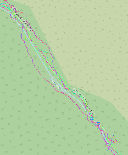
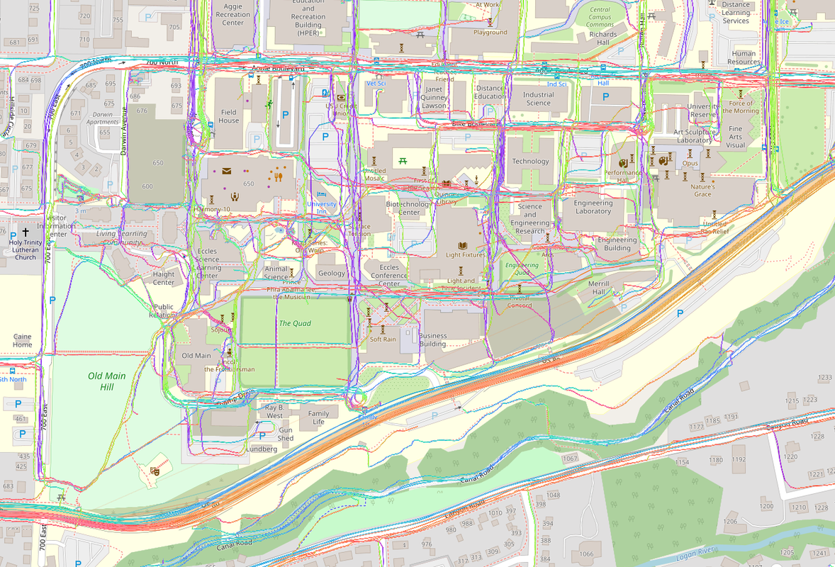
I’ve found it very enjoyable to record and upload GPS traces as I do various activities. These can help with assessing imagery offsets, route accessibility and popularity, adding brand new routes, and as a refresher after I get back from a walk, hike, bike ride, or drive. Here are some questions, issues, etc. I’ve been thinking about. Feel free to comment on any or all:
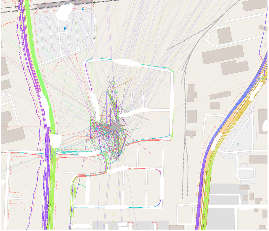
- Am I helping or hurting by uploading GPS traces with poor accuracy? They will average out as they accumulate, but there is no easy mechanism I know of to achieve this for your typical mapper.
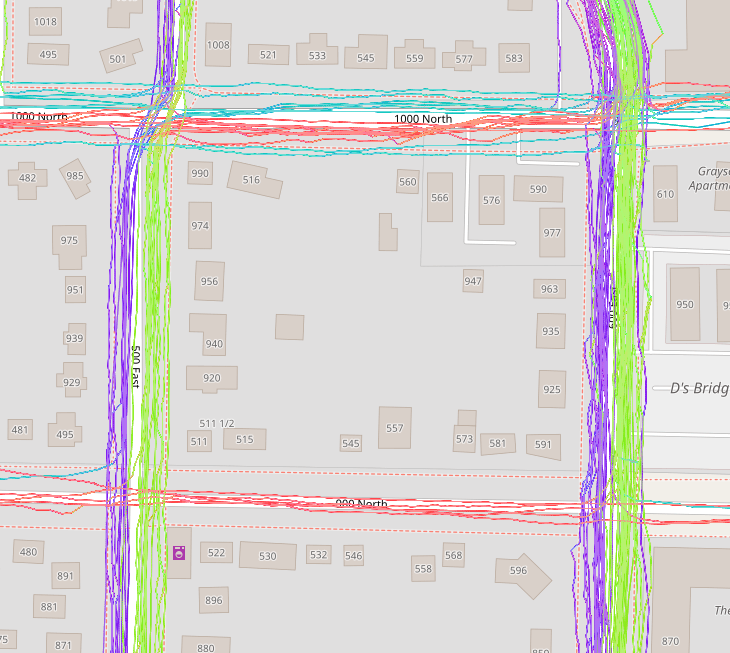
- Given that the standard OSM GPS (raster) layer doesn’t seem to favor newer traces over older ones, what happens when a road or path is moved, removed, or repurposed? All that old data is now actively harmful. (Again, in the context of the OSM raster traces layer)
- What is appropriate to upload? My 100th daily walk along the same route as always? Off-trail wilderness exploration? Airplane flight path? (IMO, the answer to all of these is either “not appropriate” or “if you really want to, as long as it’s well tagged”)
- What about people who sort of dox themselves by not turning off their GPS at home, or by owning a driving assistance device that seems to auto-upload all their travel!?
Please let me know your thoughts in a comment, and happy mapping!
Discussion
Comment from Xvtn on 6 November 2023 at 23:49
Actually, looking into the Dragon/Open/Sunnypilot issue, it looks like there is at least some discussion going on to address that: - Sunnypilot: Too Many Traces - SunnyPilot: Please simplify traces before upload - Possibly simplify traces before db insertion on OSM infra - OSM API database size growth has doubled
Comment from kucai on 7 November 2023 at 01:37
My take.
1) how poor is poor? if it’s off by 10 meters, might as well try again some other time with better gps setup. But if it is going to be the only gps track for the trail then just go for it.
2) don’t know who has the power to do the long overdue cleanup. Probably going to face some serious protest from those uploaders.
3) not appropriate. imo..
4) see #2
Comment from StephaneP on 12 November 2023 at 13:44
Osm should add a “geofence” feature. That way, gpx file would be cut near where we live/work/other area we want to hide….
Comment from Mateusz Konieczny on 22 January 2024 at 10:01
1) “Am I helping or hurting by uploading GPS traces with poor accuracy?”
if it is sort-of-matching-reality I think it is still helpful. It may in general full in bucket of “people not caring at all do low-quality stuff, people caring more refuse to do medium-quality stuff”.
And in this case having more traces is better I think, unless they are terribly bad or from travelling not on paths/roads.
2) AFAIK old data is stuck.
3) “My 100th daily walk along the same route as always?”
fine to upload, but with very diminished usability
“Off-trail wilderness exploration? Airplane flight path?”
actively harmful