OpenStreetMap

Diary Entries in English

Recent diary entries

On April 3, 2024, an earthquake happened outside the coast of Hualien, which caused serious roadblocks and human casualties. OpenStreetMap Taiwan has opened 3 projects for mapping affected areas, requesting worldwide mappers to map buildings, landuses, missing roads or waterways in Hualien.

We are talking if there is a possibility to donate the newest satellite image after the earthquake to map the after-earthquake situations. And the possibility of hosting mapping events on-site after the affected area returns to normal, helping locals by mapping the newest map data.

Location: Minyou, Chongde Village, Xiulin, Hualien County, 972, Taiwan
Posted by GOwin on 11 April 2024 in English. Last updated on 22 April 2024.

That’s the name of the workshops I facilitated last week, with the goal of introducing/promoting OpenStreetMap, along with introducing tools like FieldPaper, OpenAerialMap, Sketch-Map Tool and Umap, to meet the objectives of local DRR practitioners’ upcoming mapping initiative.

image

Last Friday I had conducted two workshop in Iloilo, one (unplanned) for Iloilo’s Provincial DRRMO (disaster agency), and another for Iloilo City own DRRMO. In the Philippines, city charters may provide them autonomy from the geographic province they’re part of. These Disaster Risk Reduction Management Offices (a tongue-full, I know) are the government agencies responsible for mitigating localized disaster risks, and planning for disaster prevention for their respective territories.

Last year, in a random visit in Iloilo, I met some folks from the City DRRMO team and since then, I found out that they’ve capturing community-based hazard risks and perceptions using FieldPapers. Unfortunately, FieldPapers uptime wasn’t as reliable as before, and eventually the built-in Bing imagery became unavailable, too.

I’ve kept in touch with the City’s DRRMO team, and when I told them of a planned (gustatory) visit, they asked if I could run another training workshop for them. The small workshop was planned for a dozen people, but the day before the workshop I was surprised to learn than they confirmed 28 participants, and couldn’t even accommodate my own guests.

Well, that’s how I ended up with two separate workshops, discussing the same topic, but interestingly, the engagement was different with one group being more technical, and familiar with geodata/GIS/maps, and the other are more focused on being able to collect local spatial knowledge.

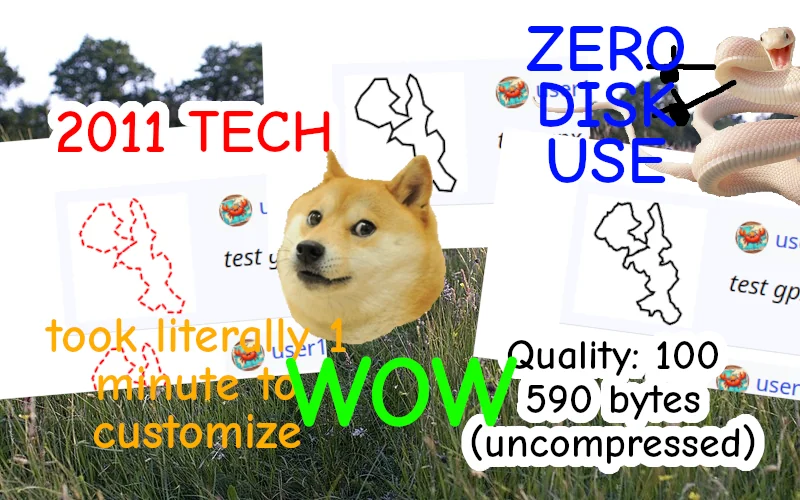
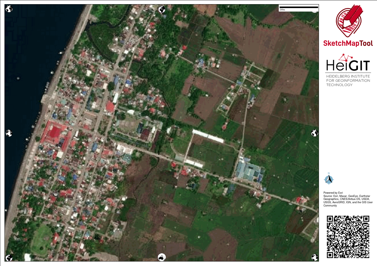
Anyway, with the feedback about issues they’ve been encountering with FieldPapers, I ran into the updated Sketch-Map Tool which now has built-in ESRI Aerial Imagery included.

FieldPapers (FP)

One of the earliest Pen & Paper tools I’ve learned to like, especially when working with folks averse to “tech”. It’s cheap, and it (used to be quite) reliable.

Creating maps could be tedious, manually requiring people to manually define their area of interest. I think it’s been years since the search function last worked properly.

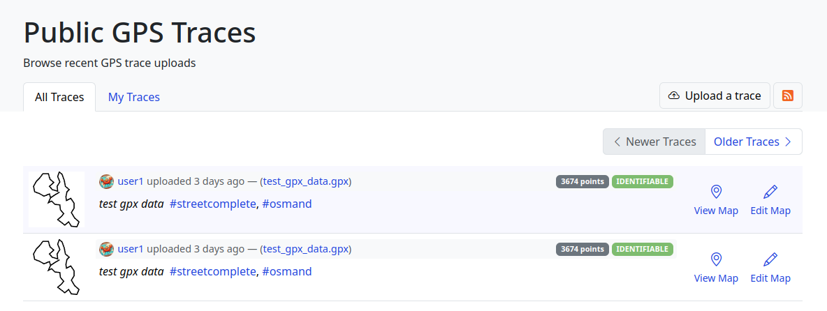
The participant’s favorite feature is FP’s ability to use external TMS endpoints, and in our case, I demonstrated how OpenAerialMap imagery taken from drones can be used to deploy fresh maps that can be used as background of maps they wish to deploy on the ground.

image

They participants also like how FP serves TMS tiles of the uploaded snapshot (marked-up) map, which they can use as a background layer on iD (or another editor) for digitizing on OpenStreetMap.

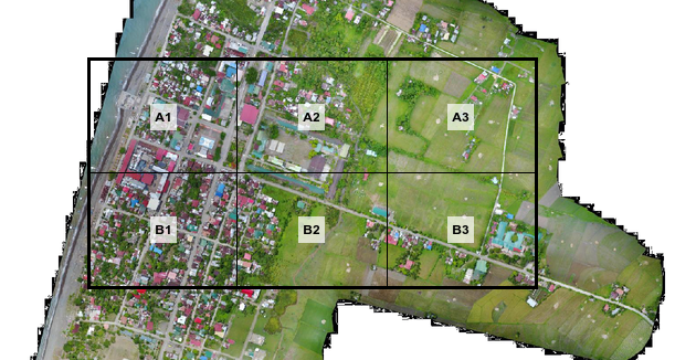
Maximum paper size is ISO A3, which isn’t probably big enough when you expect participants to work together as large groups. That size is more than sufficient for individual mappers though.

If the users aren’t conscious about it, they may inadvertently create atlases with snapshots that may reveal personal or private information, so that’s one thing users should really watch out for.

Sketch-Map Tool (SMT)

This recently revamped tool now comes with built-in satellite imagery from ESRI, but you’re limited to that or the Mapnik (OpenStreetMap’s default layer) background for your maps.

The interface for creating maps is more friendly, and the OHSOME map quality report helpful, but it becomes tedious when you need to create separate maps for a large area, which one has to to create one-by-one.

image

One of the favorite features for SMT is it’s built-in ability to digitize (properly) marked features and create GeoTIFF and GeoJSON files out of the marked-up map. The data is not stored in HEIGIT's servers, so the risk of accidental disclosure of private information is minimized. Update: 2024-04-22 According to mschaub’s comment, the data is actually stored in HeiGIT’s server, but becomes inaccessible after a day:

One small correction I would like to make (or maybe I misunderstood you): We do store the original sketch map and the uploaded sketch map with markings on them on our servers. The first one, we need to be able to do georeferencing of the sketch map after it was uploaded. The second one we store to be able to improve our machine learning models which are responsible for detecting the markings. We do point this out to the users (see text on the upload dialog). But it is not possible, even with the right URL, to download any of those files one day after they were created. So data is stored on our server, but the risk of accidental disclosure of private information is also minimized.

During the role-playing segment, we experienced how quick the process may be like, from map creation, to the mark-up/reporting process, and the automatic digitization, then visualizing the created GeoJSON files quickly, using Umap.

Over-all, everyone found the tools easy-enough to learn, and accessible for their capacity level.


At it is, these two tools are complementary and one could be more useful than the other, depending on the users’ priorities. To wit:

  FieldPapers Sketch-Map Tool
supported layer Mapnik, HOTOSM, TMS Mapnik, ESRI Imagery
interface functional, but search doesn’t work more user-friendly, works as expected
registration optional none
max. paper size ISO A3 ISO A1
geodata GeoTIFF GeoTIFF, GeoJSON
TMS of marked-up map yes no
multi-map support yes tedious
privacy risks moderate low

I’m excited by the initiatives being drawn-up by both DRRMOs, though they are still working independent of each other.

The search and rescue team, and the local fire department, were very enthusiastic about using Pen & Paper to help map location of water wells (parts of the city are experiencing drought), while the search and rescue intends to use them for mapping highways attributes (width and access) and missing footways and paths, to improve response times during emergencies.

I see a potential to make more use of OpenStreetMap data in their local communities, encouraging local contributors to keep the map updated and relevant for their own needs, and the participatory approach they are undertaking, in collecting local spatial knowledge and experience, which could lead to improved usability of gained results for local capacity assessments, and the role of the OSM ecosystem of data and tools serving as a bridge into their formal DRR process.

I would’ve loved to see more of the local active mappers participating in the event and planned activities, but unfortunately, we failed to receive any word from the folks we reached out to.

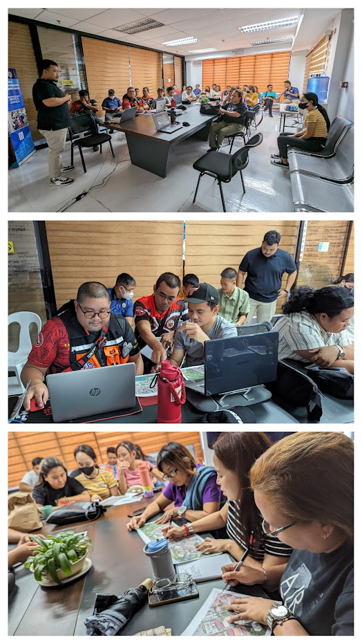
Below is a collage of some photos from the activity.

  • image
  • image
Location: Progreso Lapuz, Sinikway, Iloilo City, Lapuz, Western Visayas, 5000, Philippines

While commercial map providers like Google, provide map data in local Indian languages, the local language labels are usually transliterated from English, resulting in errors. OSM, Wikidata and Wikipedia platforms provide a way to improve the local language maps leveraging multilingual labels through Wikidata identifiers on OSM, through semi automated updates. For good quality maps on Wikipedia and OSM, the Wikidata location needs to be accurate and Wikidata identifier should be uniquely mapped to the actual OSM geometry. I worked on removing the mismatches for villages of a district in Andhra Pradesh. I have documented my experience as clearly as possible, so that even users with less programming and tools skills can contribute to the work. As an example, identifying and fixing errors in Wikidata location is given below.

Identifying and fixing error in locations on Wikidata pages

Error in Wikidata location, as the place name is not seen on the background OSM map, before the error is fixed The geodata is presented in Wikidata page and corresponding English Wikipedia article page using OSM as background map. If one notices that the marker is not near to the names identified on OSM map, then there is possibility of an error. Even if the name is identified on OSM background map, selecting different zoom levels allows checking whether the place is in the correct location.

Obtaining the correct geo location for Gurazala, Palnadu district, Andhra Pradesh using Bharatmaps The correct geolocation is obtained from Open Data compliant StateGIS portal run by Bharatmaps.

Wikipedia page with corrected Wikidata location shown on OSM map for Gurajala After Wikidata coordinate location is updated with the correct data, Wikidata page and the corresponding English wiki article show the correct map.

Full article covers how to identify more complex errors based on the geographical distance between Wikidata location and OSM node location and also when the Wikidata and OSM geometry that is associated are outside the area of interest. Sample Wikidata Sparql scripts leveraging Sophox interface to OSM, which can be easily edited are provided to help contributors with less programming and tool skills to contribute to these efforts.

For more information, check out Improving geodata accuracy on OSM and Wikidata (Full article on OSM wiki) and let me know your feedback.

Location: Jayanagar 4th Block, Bangalore South, Bengaluru Urban, Karnataka, India
Posted by Cyberjuan on 9 April 2024 in English. Last updated on 10 April 2024.

 As we announced in a previous post, we continue to inform the OpenStreetMap LATAM community about the SOTM LATAM 2024 committees, and now we present the Programming Committee.

The main functions of this committee are:

  • Propose the activity program during the days of the SOTM
  • Design protocol activities
  • Design the event Tracks
  • Design parallel activities
  • Design recreation activities
  • Coordinate with the speakers what is necessary for their participations
  • Evaluate the carrying out of recognition of mappers in the region

The committee members are:

Member Representation Position Role
Anderson Toniazo OSM Brasil Member Organizing Committee
Virginia Brussa OSM Argentina Member  
Olga Paredes OSM Bolivia Member  
Yasmila Herrera Yeka Street Member  
Sebastián Bravo Youthmappers SAGEMA Member  
Mariela Centeno Youthmappers ESPE Member  
Juan A. Barajas Youthmappers LATAM Member Organizing Committee

This committee should have its first meeting in the coming days to elect its president and begin carrying out its duties.

Location: El Porvenir, La Oroya, Province of Yauli, Junín, Peru
Posted by Cyberjuan on 9 April 2024 in English. Last updated on 10 April 2024.

 As we announced in the previous post, we continue to inform the OpenStreetMap LATAM community about the SOTM LATAM 2024 committees, and now we present the Academic Program Committee.

The main functions of this committee are:

  • Evaluate the presentation proposals received
  • Evaluate scholarship applications received
  • Management of travel and accommodation scholarships

As additional information for those interested in presenting a talk or presentation, the topics may be (but are not limited to):

  • Mapping projects developed or under development in the region.
  • Projects to improve the labeling system in the region.
  • Projects to improve the use of notes in the region.
  • Extrinsic or intrinsic quality assessment of OpenStreetMap data
  • Analysis of contribution patterns in OpenStreetMap
  • Generation of new and scientifically valuable datasets from OpenStreetMap
  • Assessments of data import procedures and their impacts on data and community
  • Integration between OpenStreetMap and other data sources (authoritative, user-generated, or otherwise valuable to OpenStreetMap)
  • Analysis/comparison of available software for scientific purposes related to OpenStreetMap
  • Novel approaches to facilitate or improve data collection and/or data quality in OpenStreetMap (e.g. through gamification or citizen science approaches)
  • Artificial Intelligence / Machine Learning from, and with OpenStreetMap (e.g. AI-assisted mapping)
  • Open research problems in OpenStreetMap and challenges for the scientific community
  • Cultural, political, and organizational aspects of data production and usage practices in OpenStreetMap
  • Studies using OpenStreetMap data in scientific domains
  • Reviews of any scientific aspect connected to OpenStreetMap

The committee members are:

Member Representation Position Role
Rodrigo Smarzaro UMBRAOSM Member Organizing committee
Matheus Correia COIMBRA Univ. Member  
Nathan Damas Youthmappers UFPR Member  
Kauê de Moraes V. Youthmappers UFPR Member  
Maya Lovo Youthmappers Member  
Carolina Garcia Youthmappers ESPE Member  
Patricia Llanos SBCS Member  
Sandra Hernandez Youthmappers Uaemex Member  

This committee should have its first meeting in the coming days to elect its president and begin carrying out its duties.

Location: Huanchaquito, Huanchaco, Province of Trujillo, La Libertad, 13000, Peru

Welcome to my fourth OpenStreetMap NextGen development diary.
Sorry for being a day late! I wanted to finish up one of the new features which caused this small delay. ✨

🔖 You can read my other development diaries here:
https://www.openstreetmap.org/user/NorthCrab/diary/

🐙 My work is available publicly on this GitHub repository:
https://github.com/Zaczero/openstreetmap-ng

GitHub stars counter

Let’s summarize the last week’s work:

Client-side Trace Images

While migrating the traces functionality, I came up with an amazing and seemingly obvious idea. Why not make trace images SVGs and render them client-sided? This feature has few significant advantages: even faster trace uploading, no additional disk usage, unlimited customization, infinite resolution, faster page loading. And so here it is:

Comparison screenshot of the new client-side generated trace images (SVGs)

The application can freely adjust the quality of generated images. The code can also be reused for implementing proper trace-on-map rendering, which is one of the new upcoming features.

SVG supports animations too!

Animated trace using SVG

Refreshed Traces UI

Screenshot showcasing refreshed public traces UI

» Open in full screen

Last week I have also worked on refreshing the traces UI, focusing on making it more open and friendly. If you have been following my previous diaries, you may recognize some of the new style language.

Deployment Scripts

I also wrote and successfully tested server-deployment scripts for the application. They are currently a part of the openaedmap-backend project but will soon be copied over to the openstreetmap-ng. Both projects share many similarities in how they are run.

Final Words

Previous development diary #3 was packed with lots of new stuff. I took this week a little slower to catch a breath. Meantime, I contributed to other projects (openaedmap, starlette) and also helped OSM-PL with server migration process. I was also away for a short time for some BBQ🌞!

Project Sponsors 🏅

Thank you to this week’s project patrons! I truly appreciate your every contribution!

Currently, the project is sponsored by 11 people!
Five private and three public donors on Liberapay, and three public on GitHub Sponsors.

If you can, please consider supporting the NG development. Any amount helps me focus on making high-quality free software for everyone to enjoy! (shh… next week I will announce a new supporter benefit) 😋

Donate using Liberapay

Disclaimer

This project is not affiliated with the OpenStreetMap Foundation.

Posted by Eden Oluigbo on 8 April 2024 in English.

Not A Goodbye!

Two friends waving at each other

This is the Closing Chapter! However, the story continues😀

My friend (and colleague) Ola messaged me and asked, “Eden, how do you feel, that your internship at HOTOSM is ending soon?” I took a long pause to answer that 🥹.

As the curtains draw close on this chapter of my professional journey, I find myself reflecting on colourful experiences, lessons, and memories that have defined my time as an intern at HOTOSM.

It’s been 3 months already!?🥹 Like someone rightly said “time goes by quickly, when you are having fun”. I’m usually the type of person that looks forward to the end of a thing because I learnt to always finish what I started. But this time, it felt weird! A mix of nostalgia and anticipation.

I love it at HOT and I will forever cherish my time here; where every encounter was a lesson and every challenge a stepping stone. The vision, the community, the staff, the enriching days of inspiring coffee chats, talks with my favourite colleague, the opportunities, the work I did, and my wonderful mentor, Petya Kangalova.

Throughout these past 3 months, I’ve been privileged to be guided by the most amazing mentor ever, Petya Kangalova, who generously shared wisdom, resources, expertise, and opportunities for me to grow. Each day presented a fresh “GO!” for me to experiment, iterate and grow. From navigating the complexities of projects to engaging in insightful conversations on Mondays (and other days). Every moment has contributed to my development as a professional and my confidence as an individual.

What’s next?

I’m proud of myself for the work I did, and the initiatives I took in an attempt to maximise my time with HOT. I got really sweet feedback that will forever keep me motivated. And the story continues, it doesn’t end now. Not anytime soon. I am thankful for the opportunity to be a co-mentor for the next round of Outreachy internship at HOTOSM.

Part of what’s next for me is to continue contributing to HOT’s open source project, with a special interest in HOT’s fAIr software. fAIr is an open AI-assisted mapping service software, that aims to improve the efficiency and accuracy of mapping efforts for humanitarian purposes.

If you’re a beginner to open source and don’t know where to start, but excited to do so, I recommend joining the HOT Tech and Innovation Working Group to learn and grow your skill, within an inclusive community. And If you want to get your hands busy right away, check for “good first issues” or “beginner friendly issues” at the HOT Github page.

You can also watch this comprehensive video guide on how to contribute to HOTOSM open source projects on Github. Listen to our active contributors share their experience contributing to HOT’s open source project.

C’est fini – but it is also a new beginning. With a heart of gratitude and determination, I step forward, eager to embrace the next challenge, and open to the endless possibilities that await beyond the threshold of familiarity.

Special thank you to my mentor, Petya Kangalova. Thank you HOTOSM, Outreachy internship – you have been more than a chapter; you have been a transformational point in my professional journey, guiding me towards the horizon of endless possibilities.

If this is your first time reading my diary, please catch up with my previous blogs here or connect with me and reach out via X @edenxcodes to stay updated on my next steps.

Till next time,
Eden.

Posted by GovernorKeagan on 7 April 2024 in English.

Overview

Progress has been solid over the past week. My main focus is still trying to add in as many missing buildings as possible, but I’ve covered the following during the week:

  • Micromapping. While fixing two schools and two shopping centres, I decided to micromap them using a combination of aerial imagery and my local knowledge.

  • More buildings. I’m still just trying to “fill in the blanks” and get buildings added.

  • Small fixes. While doing other mapping, I came across various small issues that I fixed at the same time.

Micromapping

Schools

While updating some details for Victoria Park High School & Victoria Park Primary School, I decided to micromap them while fixing some misalignments. I tried to map in a way that makes sense and not just to make it look pretty on the renderer.

While doing this, I noticed that the park next to the High School had some seemingly strange boundaries. I need to do some more research to confirm where the park boundaries lie, so for now it remains the same.

Shopping Centres

Similar to how I started with the schools, I wanted to correct some details and fix some “wonky” mapping from older imagery. I ended up doing some pretty detailed micromapping except for changing some shop details - I know that they aren’t there any more, but I don’t have the current shop details at the moment.

More Buildings

I’m very happy with the progress that I’ve made. It’s slow at times, but it is moving and I can see the difference. There has been a decent amount of properties that had a node with address but no area mapped for the building. This has come in handy once or twice where I could verify the building to ensure that it is still there, which wasn’t always the case.

Having said that, it would still be great for a local to confirm all of this, there’s only so much I can do from Ireland.

Small Fixes

While doing other mapping tasks, I have tried to correct any other issues at the same time. Generally, this has been correcting some wonky alignment of roads. It’s easier to fix these things at the moment then trying to go back and fix a larger issue.

General Observations

Just a couple of things I’ve noticed while working on this project.

  1. I mentioned this already, but I’ve come across a good number of buildings that have only had an address node over the building (without any area mapped).

  2. I noticed that someone had micromapped some residential properties. While I’m all for micromapping (I did a decent amount this week), adding trees to someone’s back garden seems a little strange.

  3. The satellite imagery is really good! I would love it if Ireland had the same high quality imagery.

  4. There is next to no landuse=residential or landuse=retail mapping. While I’m 90% sure of what is a business and what is a residential property, a lot has changed in the almost 6 years since I was last in South Africa. I’ve added a little, but for the most part I’ll leave it for a local.


Before:

Start of the week before I started mapping.

After:

Progress as of the 7th of April (1 week of mapping)

Before: Victoria Park High School

The main buildings were mapped already, but they lacked detail.

After: Victoria Park High School

Details added, as well as some micromapping.

Before: Victoria Park Primary School

Similar story to the above.

After: Victoria Park Primary School

Details added, as well as some micromapping.

Location: Nelson Mandela Bay Ward 3, Gqeberha, Nelson Mandela Bay Metropolitan Municipality, Eastern Cape, South Africa
Posted by PineappleSkip on 6 April 2024 in English. Last updated on 11 April 2024.

Guidance missing for Queensland

There is no clear indication on the Australian Tagging Guidelines/Roads about how Queensland Roads should be classified according to a national hierarchy.

This diary note is about rural roads. I live in a smallish country town and there are few urban roads that aren’t covered by the rural roads hierarchy

Classification and tagging in Australia

The primary guidance appears to be the comprehensive Victorian classification, which classified roads as M, A, B, C or D, or unclassified, with M, A, B and C routes signed. These are to be tagged as Motorway, Trunk, Primary, Secondary and Tertiary.

Victoria, Tasmania and South Australia sign C roads (with the exception of a handful of South Australian Roads) and the extent of the classifications varies by State or Territory. NSW only signs A and B roads.

NSW classification and tagging.

NSW is significant to Queensland classification as the primary traffic interface to Queensland is NSW. Traffic into South Australia and the Northern Terrirory is negligible by comparison.

NSW readily corresponds to Victoria at the top levels with M, A and B roads as corresponding to the Victorian Hierarchy.

The NSW Roads Act 1993 specifies an elaborate classification, but tagging is based on simplified NSW Main Road classifications at the B and below level. The two categories are State Roads and Regional Roads. 1. State Roads, which are largely A and B roads but include some others (e.g. Byrock to Brewarrina, Tumut to Tumbarumba) which are unnumbered. (as noted above M and A roads are tagged as higher in the hierarchy). 2. Regional Roads, which appear to be the balance of NSW Main Roads.

For Openstreetmap, NSW State Roads, whether signed as B or not, are tagged as primary roads. Regional Roads are tagged as secondary roads. There is a clear source for contributors in this Official Map of classified roads

Suggested Queensland classification

There is a useful discussion of the classification system in Queensland in the Ozroads website which provides background. The names applied to important roads generally reflect an old classification which named State Highways and Developmental Roads, the latter being roads in remote areas which were originally constructed to a lesser standard to State Highways but have since been progressively improved.

Queensland only gives letter designations to roads classified as M (motorway) and A (primary) roads, with a broadbrush categorisation resulting in a couple of B NSW roads crossing the border and becoming A Queensland Roads (B71/A71 at Barringun, B55/A55 at Hebel). These roads would readily map to the Motorway and Trunk OSM classifications, and review of some examples indicates that’s done fairly consistently.

Most Queensland roads have not been signed using the M, A, B categorisation, and National Routes and State Routes are badged to many roads. However the existence of signage on the ground, particularly for those that aren’t M roads or A roads, is haphazard and often non existent, meaning route signage is often available for ground-truthing classifications and tagging the classification of roads.

There is a further numbering system which is administratively used by TMR that

Like NSW, Queensland has a “State Road Network of Queensland Map” maintained by its Department of Transport and Main Roads (TMR) showing a categorisation of significant roads available online. This would provide a ready means for contributors to identify the classification of roads.

TMR has a hierarchy of four categories of rural roads in Queensland according to this classification, all of which are higher in the hierarchy than roads that are not. There is a fifth category which overlaps the fourth.

  1. National Road Network, Tag as Motorway or Trunk as appropriate. All of these roads are A or M classified roads. All are sealed. There are also a few franchised roads around Brisbane, which are tollways built under build own operate type arrangements and also signed as M roads.

  2. State Strategic Road Network. Tag as Trunk. These roads are all named as highways, with one exception, which is a developmental road. The bulk of these, but not all, have been given A route designations. All are sealed. There is consistency with the guidelines as applied to other states in tagging these highways as trunk and they appear to be so tagged.

  3. Regional Road Network. Tag as Primary. These roads include the balance of the State Highway network and the most important main roads. Thgey are largely sealed, although there are many sections in outback areas that are unsealed. There appears to be some correlation with the roads classified as State Roads in NSW, for which the tagging guidelines specify tagging as Primary.

  4. District Road Network. Tag as Secondary. This is the balance of the TMR owned roads and all correspond to either main roads or secondary roads in the old TMR classification. They are comonly known as main roads as they are owned* by TMR rather than local authorities.

  5. Local Roads of Regional Significance (LRRS). Tag as Tertiary, together with other roads os similar significance. These are also shown on the map and are a combination of District Roads (owned by TMR) and other roads (owned by local councils). They are described by TMR as State roads and council roads that have a similar function. There are a roughly equivalent number of LRRS which are state roads and local roads. It would be logical to tag local roads of regional significance which aren’t in category four as tertiary roads, however this is likely to be an incomplete guide to tertiary roads. This is because LRRS status is applied for by councils and a section of a connecting road in one council may have been designated as a LRRS but not in an adjacent council.

*The Roads described are are all public roads owned by Government, but I have used the term owned in this note to refer to the maintenance responsibility. For the four categories of TMR roads, TMR funds maintenance, and for most other roads maintainance if funded by local councils.

Footnote

I also discovered that there is a dataset maintained by Department of Resources with a data dictionary. This could be a more complete guide than the TMR, but I haven’t researched this much (yet).

Posted by Cyberjuan on 5 April 2024 in English. Last updated on 10 April 2024.

 It is with great excitement that we present to you the Organizing Committee of the SotM LATAM 2024 which will take place in Belem, Brazil, from December 6 to 8 of this year.

This volunteer committee has, among others, the functions that the SotM Working Group assumes in the global SotM, that is, mainly:

  • seeking a host location,
  • arranging sponsorship,
  • organising the detail of the conference,
  • promoting the conference, and
  • running the conference.

This committee is made up of those who, at the last AbreLatam 2023 in Montevideo, Uruguay, had the initial idea of holding the SotM Latam together with the FOSS4G 2024 that was announced at said event. Other map enthusiasts have been joining this initial group, contributing different visions and perspectives that we are sure will enrich SOTM LATAM 2024.

Member Representation Position Role
Raphael de Assis UMBRAOSM President Local committee
Roberto de Andrade UMBRAOSM Secretary Local committee
Vitor George Brazil Community Member IT
Anderson Toniazo Brazil Community Member Academic committee
Rodrigo Smarzaro Youthmappers UFV Member Local committee
Tatiana Pará OsGeo Brasil Member FOSS4G, Local committee
Selene Yang Geochicas Member Diversity, Equity, Inclusion
Juan Ángel Barajas Youthmappers LATAM Member Programming committee
Juan Arellano OSM LATAM Member Comunication

We will soon be announcing the formation of the other work committees: Local committee, IT/Communications committee, Programming committee and Academic committee.

Location: Mario Rivera, Yavari, Province of Mariscal Ramón Castilla, Loreto, Peru

Presentation of the Organizing Committee of SOTM LATAM 2024 in Brazil. Amazônia, Belém - Pará Brazil

It is with great excitement that we introduce you to the Organization Committee of SotM LATAM 2024 that will take place in Belén, Brazil, from December 6 to 8 of this year.

It is with great excitement that we introduce you to the Organization Committee of SotM LATAM 2024 that will take place in Belén, Brazil, from December 6 to 8 of this year.

This volunteer committee has, among others, the functions that the SotM Working Group assumes in the global SotM, that is, mainly:

Determine the location of the event, Coordinate sponsorships, Approve the event schedule, Promote the event Direct the event. This committee is made up of those who, at the last AbreLatam 2023 in Montevideo, Uruguay, had the initial idea of ​​holding the SotM Latam together with the FOSS4G 2024 that was announced at said event. Other enthusiasts have been joining this initial group, contributing different visions and perspectives that we are sure will enrich SOTM LATAM 2024.

Member Representation Position Function

Raphael de Assis UMBRAOSM President Local Committee

Roberto de Andrade UMBRAOSM Secretary Local Committee

Vitor George Community Brazil Member IT

Anderson Toniazo Community Brazil Member Academic Committee

Rodrigo Smarzaro Youthmappers UFV Member Local Committee

Tatiana Pará OsGeo Brazil FOSS4G Member, Local Committee

Selene Yang Geochicas Member Diversity, Equity, Inclusion

Juan Ángel Barajas Youthmappers LATAM Programming Committee Member

Juan Arellano OSM Peru Member Communication

We will soon be announcing the formation of the other work committees: Local Committee, IT/Communications Committee, Programming Committee and Academic Committee.

Organizing Committee of SotM Latam 2024 Belém - Pará - Brazil https://wiki.openstreetmap.org/wiki/ES:LatAm/Eventos/State_of_the_Map_Latam_2024 https://2024.osmlatam.org/

Contact: state@osmlatam.org

Location: Marco, Belém, Região Geográfica Imediata de Belém, Região Geográfica Intermediária de Belém, Pará, North Region, Brazil
Posted by mayanaut on 5 April 2024 in English.

I’ve gotten most, if not all of the sidewalks mapped out within Avalon Borough. As I’ve worked eastward from Ben Avon, I’ve encountered a few other sidewalks mapped separately, many of which do not specifically note pedestrian crossings, so I plan to comb over those to see what I can make more consistent. There is a section of ORB/PA-65 where there are many crossings that are not tagged correctly. As this section is chock-full of turning vehicles, this seems rather dangerous, so I’m going to go through that area to map and tag things with pedestrian safety and accessibility in mind.

I have proceeded across the border into Bellevue, as well, with many of the above concerns in mind while tracing aerial photography.

Location: Avalon, Allegheny County, Pennsylvania, 15202, United States

Don’t worry, I won’t write a report every week!

So, the second week of capturing imagery with the GoPro Max granted by Meta is over. I’ve uploaded around 30,000 images since I started, but I’m not quite sure how many.

Here’s a little animation of my progress. It certainly helps me to stay motivated, if I can visualize my progress:

I still have only used it cycling and walking, but I had an ebike at my disposal on Easter Monday which was great for two reasons: The streets weren’t as busy because of the holiday, and I could obviously cover more ground. This was the only day so far that the camera battery ran out of energy before me. I might borrow it again to venture out further into the country.

I used the camera on the public bus as well, but obviously couldn’t use the 360 deg function, but instead just held it against the bus window from the inside. Not ideal, but I got some coverage of roads that had not been covered on Mapillary before at all. (Those do not appear in the animation, because I filtered for 360 imagery.)

It seems that Mapillary deals with the images a bit faster than during the first couple of days; usually they are fully processed after about two days now.

Interview on local radio

Yesterday, I gave a wee interview on one of our local radio stations about the project. I had hoped to inform the public about it that way, so that I don’t get as many looks of bewilderment, but I’m not sure that very many people listen to that radio station. If you’re interested, this is the link, and it starts around 47:59. It’s a bit of a pity I discovered that holy well, because it took valuable time off the interview which could have been used to address issues about privacy or whatever. However, I had suggested mentioning the holy well to him before the interview in the hope of finding out more about it, but then I found it out between that and the interview, but he liked the local history angle, I guess, so we stuck with it.

Panoramax

I’ve also started uploading some of the images to Panoramax, more as a test than anything, because we don’t have our own Irish instance of it yet. The uploading works like a charm, only it doesn’t show a map in the background: Panoramax screenshot

There’s a storm warning in place until tomorrow evening, so I don’t know if I will be able to keep up my streak, especially since I have to cycle further to even start capturing now.

Posted by spwoodcock on 4 April 2024 in English. Last updated on 13 April 2024.

ODK

For those that don’t know, ODK is an incredible suite of tools for field data collection.

The Field Mapping Tasking Manager(FMTM) leverages two of their tools to coordinate field tagging of map data:

  • ODK Central as the centralised server to store survey data.
  • ODK Collect as the mobile app for survey-based data collection on mobile phones (working very nicely in offline contexts too).

Entities

  • ODK Entities were introduced to Central in September 2023, in order to more easily track the same feature over time.
  • As a result, we have a nice way to store a feature, with geometry and properties, in ODK Central.
    • This could quite easily map to the OSM ID, feature geometry, and feature tags.
  • The geometry can then be selected in ODK Collect survey questions.

select-from-map-polygon

How To Use Entities

Create an Entity List

Within ODK Central, a collection of Entities is called an Entity List (or dataset via the API).

Currently the only way to define an Entity List is to submit a XLSForm with an ‘entities’ tab defining the entity_id field:

entities-tab

And a ‘survey’ tab defining additional properties/field for the Entities:

entities-survey-tab

Example generic Entity form

  • This will change in the future, with the possibility to create an Entity List / dataset via the Central API.

Populate Entities

Once the Entity List exists, you must populate the data:

Option 1: via the API. Manually uploading the Entity details.

Option 2: via CSV attachment. Entities can be uploaded as a CSV attachment to a form (in theory, although I have yet to make this work!).

Option 3: created automatically on submission by specifying a ‘geopoint’ or ‘geoshape’ field in your form (and collecting the location in the field).

Changes to FMTM

Until now, FMTM was frankly abusing ODK Central and had a structure like this:

FMTM Project 🔗 ODK Project

FMTM Task Area 🔗 ODK XForm (the survey)

FMTM Geometry 🔗 ODK XForm Attachments

This resulted in potentially hundreds of ODK XForms per project, which is not an ideal usage.

With Entities, the new mapping for FMTM is:

FMTM Project 🔗 ODK Project, ODK Entity List (Dataset), ODK XForm

FMTM Task Area 🔗 Group of ODK Entities (via task_id property)

FMTM Geometry 🔗 ODK Entity

This is a much more logical 1:1 mapping of the lowest level unit we are interested in: OSM features.

A World of Possibilities

  • Now Entities exist, it is possible to update Entity fields, as they are mapped in the field.
  • For example, after tags have been added to an OSM feature in FMTM and mapping is complete, a ‘STATUS’ field could be updated for the Entity as ‘complete’. This would inform other users of ODK Collect that this building has already been mapped.
  • Even more intuitively, the feature could be ‘soft deleted’ after mapping, so it so the geometry disappears entirely from another users phone. Or the Entity label could be updated with a big ✅.
  • There is a whole section on updating Entities from forms in the ODK documentation.

So Where Does OpenStreetMap Come In?

  • The goal of FMTM is to add useful field-verified metadata (tags) to features on a map.
  • For example, we have the outline of a school, but wouldn’t it be great to know: how many stories it is, what the walls and roof are made from, how many people are typically inside the building during the day?
  • FMTM mostly uses OSM data for import and updating these tags (it is also possible to use custom data that does not exist in OSM (yet!).
  • ODK Entities are essentially a representation of these OpenStreetMap features, that can be updated from detailed ODK surveys done in the field.
Location: Kalgodin, Ouagadougou, Kadiogo, Centre, Burkina Faso