
DOST - Project NOAH (ISAIAH) finishes mapping building footprints in Cavite
Posted by feyeandal on 29 June 2016 in English. Last updated on 2 July 2016.OpenStreetMap contributors, through the initiative of ISAIAH (Integrated Scenario-based Assessment of Impacts and Hazards) component under DOST - Project NOAH (Nationwide Operational Assessment of Hazards), have recently completed mapping the building footprints of Cavite.
One of the objectives of ISAIAH is to map the exposure elements such as buildings and critical facilities. Identifying the critical facilities such as schools, hospitals, and government offices, and other infrastructures will be essential in determining the areas vulnerable to disasters and can be used as a starting point in reducing disaster risk. All of these data will be used in improving community disaster management before, during and after emergencies. This initiative involves a collaborative partnership with the OpenStreetMap community.
Last March to April, Project NOAH conducted a series of OpenStreetMap training to its staff to digitize the building footprints in the selected provinces in the Philippines using the available imagery from Bing and MapBox. The provinces were selected according to the available imagery, land area and population of the provinces, and the available population data we have from the Philippine Statistics Authority as of 2010. Accordingly, Project NOAH created a mapping task on the HOT Tasking Manager for the province of Cavite. Since then, Project NOAH staff and OSM community started contributing to the mapping task.

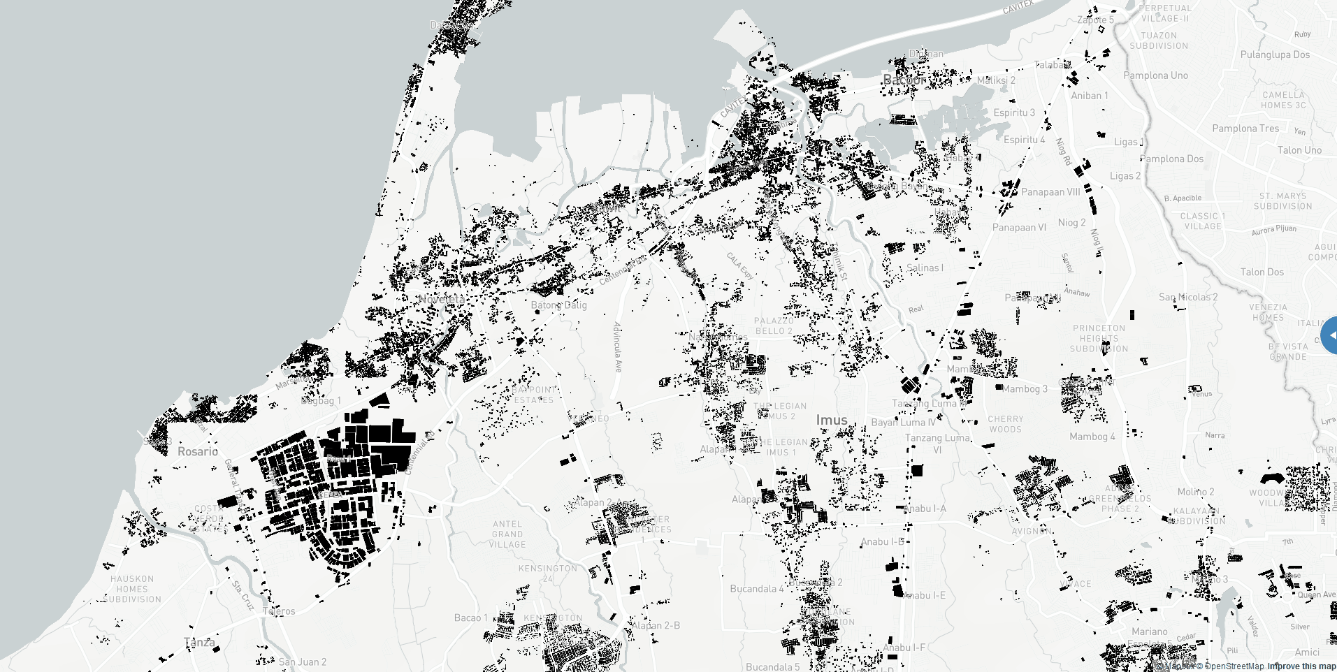
As of June 28, the mapping task for Cavite is 100% complete and 18% validated. This mapping initiative helped increase the number of building footprints in Cavite from 110,506 to 631,825.
Below is the image of the downloaded building footprints in Cavite as of June 28.

You may view the map comparison of before-and-after edits here.
The translated building footprints data from OpenStreetMap are being utilized in one of Project NOAH tools, the WebSAFE application. It is used as an impact assessment tool for end-users to be able to readily identify the number of affected people and buildings in case a hazard scenario like flood affected a certain area. Using this tool, local government units can easily identify how many relief goods are needed to be allocated when a severe weather event happens.

Thank you for helping us map Cavite!
Project NOAH recently opened a new task for the province of Zambales. Click here to help us map the province. :)
Discussion